Guajataca Beach (Quebradillas side) Quebradillas, Puerto Rico
Quick Facts
About Guajataca Beach (Quebradillas side)
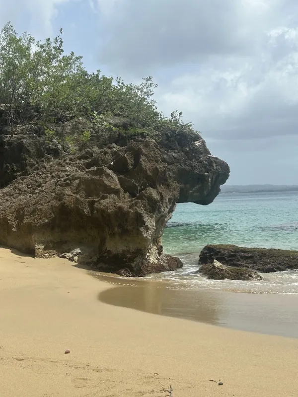
Guajataca Beach on the Quebradillas side features a dramatic wide sandy arc nestled beneath towering limestone cliffs near the historic Guajataca railway tunnel. This scenic stretch of Puerto Rico's rugged north coast is characterized by strong Atlantic currents and steep drop-offs, making it ideal for walking and photography rather than swimming. The beach offers striking views of rock formations, sea caves, and coastal vistas that exemplify the raw natural power of the region.
Visitor Tips
- Arrive before 10am to secure the best parking spots and beach locations
- Golden hour (shortly after sunrise or before sunset) provides the best lighting for photos
- Bring your own food and drinks - limited vendors in the area
- Help preserve the beach beauty by taking all trash with you when you leave
- Bring plenty of water - staying hydrated in the tropical heat is essential
History & Background
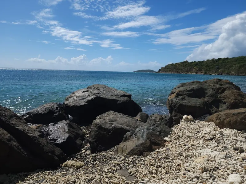
Guajataca Beach on the Quebradillas side marks the boundary where two municipalities meet along one of Puerto Rico's most dramatic stretches of coastline. Quebradillas, founded in 1823, takes its name from the many small quebradas (streams) that cut through the karst terrain on their way to the sea. The municipality's northern coast is defined by towering limestone cliffs, sea caves, and narrow beaches wedged between rock walls, a landscape carved over millions of years by the collision of ocean and stone.
The most famous landmark in this area is the Guajataca Tunnel, a railway tunnel blasted through the coastal cliffs in the early 1900s as part of the island's circumferential rail system. The railroad, which connected San Juan to Ponce via the northern coast, was an engineering marvel of its era. Trains passed through the tunnel with the Atlantic crashing against the cliffs on either side, offering passengers one of the most dramatic views on the entire route. The rail system operated until 1953, when highway expansion made it obsolete. The tunnel now remains as a pedestrian attraction and a reminder of Puerto Rico's railroad age.
Guajataca Beach sits near the base of these cliffs, a wide sandy arc that collects sand transported by currents along the north coast. The beach is bounded by rock formations that create a natural amphitheater effect, with the cliffs rising behind and the open Atlantic stretching ahead. This geography creates strong currents and wave patterns that make the beach better suited for walking and observation than for swimming, a characteristic well known to locals.
Best Time to Visit
Guajataca Beach is primarily a walking and scenery beach rather than a swimming destination, so seasonal conditions matter less than at swim-oriented beaches. However, timing your visit strategically enhances the experience.
- December through April (Dry Season): Offers the most comfortable weather for walking the beach and exploring the surrounding cliff areas. Rainfall is less frequent, and the light during early morning and late afternoon creates striking contrasts on the rock formations.
- Winter months: Bring larger swells that produce dramatic wave action along the cliffs and at the beach. While this makes the water more dangerous, it also creates the most visually impressive conditions, with waves crashing against the rocks. Photographers and nature observers will find winter the most rewarding.
- Summer (May through November): Conditions are calmer, with smaller waves and warmer air temperatures. If you want to approach the waterline more comfortably, summer is more accommodating. However, afternoon thunderstorms are more common, and the heat can make extended cliff walks uncomfortable.
- Weekdays, especially mornings: Offer solitude and unobstructed views. Weekends bring moderate local crowds, particularly during summer weekends and holidays, with parking areas filling up on busy Sundays.
Getting There
Guajataca Beach is accessible via PR-2, which runs along Puerto Rico's north coast. The beach is positioned near the municipal boundary between Quebradillas and Isabela, so directions may route through either municipality depending on your starting point.
- From San Juan, take PR-22 west, which becomes PR-2 past Arecibo. Continue on PR-2 west through Hatillo and into Quebradillas. The drive takes approximately 1 hour and 45 minutes from the San Juan metro area.
- From Isabela to the west, head east on PR-2 for about 10 minutes to reach the Quebradillas section of Guajataca.
- From Arecibo to the east, the drive west on PR-2 takes about 20 minutes.
- Watch for signs indicating the Guajataca area and the tunnel. Turn north toward the coast on PR-113 or local roads that access the beach.
A parking area near the beach accommodates a moderate number of vehicles. The lot is basic, with unpaved surfaces in some sections. During peak periods, additional vehicles park along the road shoulders. The walk from parking to the beach is short, though the path may involve navigating uneven terrain near the cliff base. Public transportation does not serve this specific location, so a car is necessary.
The Guajataca Tunnel trailhead is nearby and can be visited as part of the same trip. If you plan to visit both, park in the tunnel area and walk to the beach, as the connecting trail is relatively short.
What to Bring
Since Guajataca Beach is better suited for walking and exploration than swimming, your packing list should reflect a hiking and sightseeing outing rather than a traditional beach day.
- Footwear and Safety: Comfortable walking shoes with good traction are essential, especially if you plan to explore the rocky areas near the cliffs or walk the tunnel trail. The limestone rock can be slippery when wet.
- Sun Protection: Sunscreen and a hat are necessary for the exposed beach walk, as shade is limited to the cliff base areas. A light rain jacket is worth carrying during the wetter months, as weather can shift quickly along the north coast.
- Hydration and Sustenance: Bring drinking water and snacks, as there are no vendors at the beach itself. The nearest food options are in Quebradillas town or along the main road, a short drive away.
- Photography and Observation: A camera is highly recommended. The cliff formations, the tunnel entrance, and the wide beach arc provide numerous photographic opportunities. Binoculars enhance the experience for birdwatchers, as the cliffs host nesting seabirds and the waters offshore sometimes attract marine birds.
- Environmental Responsibility: Bring a trash bag for any waste, as there are limited garbage facilities at this location.
Nearby Attractions
The Guajataca area offers several attractions that complement a beach visit and showcase the region's natural and cultural heritage.
- Guajataca Tunnel: This former railway tunnel, roughly 200 feet long, has been converted into a pedestrian walkway with views of the coast from both ends. The trail system around the tunnel extends along the cliff tops, offering elevated perspectives of the ocean and the coastline stretching in both directions. It is free to access and suitable for visitors of moderate fitness.
- Guajataca Forest Reserve: Located about 20 minutes inland, it provides over 25 miles of trails through karst terrain. Trail number 1, which follows the cliff edge, is the most popular and offers views of the forested mogotes and interior valleys. The cave trail leads to a small cavern with formations accessible via a short detour. The forest is free to enter and well maintained by the DRNA.
- Isabela's Route 466 Surf Strip: Roughly 15 minutes west, this area offers restaurants, surf shops, and beach access at Jobos and other breaks. It is the closest area for dining, entertainment, and a contrasting beach experience with its surf culture atmosphere.
- Quebradillas Town Center: About 10 minutes south on PR-113, the small plaza, local restaurants, and panaderias provide a glimpse of traditional Puerto Rican small-town life. The town's annual patron saint festival in November brings parades, music, and food stalls to the streets.
- Lake Guajataca: About 25 minutes inland, this freshwater reservoir offers fishing and scenic views surrounded by forested hills. A drive around the lake passes through rural mountain communities and coffee-growing areas.
Local Tips
- Do Not Swim: The currents here are among the strongest on the north coast, and the beach drops off steeply. These conditions have caught even strong swimmers off guard. Enjoy the beach from the sand and rocks, but stay out of the water unless conditions are unusually calm and you are a very experienced ocean swimmer.
- Visit the Tunnel Early: The tunnel area can become crowded on weekend afternoons, particularly when tour groups arrive. Visiting the tunnel early in the morning or on a weekday provides a more personal experience and better photographs without other visitors in the frame.
- Stay on Established Paths: When walking along the cliff trail near the tunnel, stay on the established path. The cliff edges are unfenced in many areas, and the limestone can crumble unexpectedly. This is not hyperbole; sections of cliff face do collapse, and the consequences of a fall are severe. Keep children close and supervised.
- Plan Meals in Advance: There are no vendors at the beach. For food, drive into Quebradillas or Isabela. In Quebradillas, small roadside fondas serve economical lunch plates. In Isabela, the Route 466 corridor offers more varied dining options at slightly higher prices.
- Photograph During Golden Hour: The best photographs of the beach and cliffs are captured during the golden hour before sunset, when the low-angle light illuminates the rock formations in warm tones. On clear days, you can see the Isabela coastline stretching to the west, with the cliff formations creating a serrated profile against the sky.
Visitor Photos
Sign in to addNo photos yet. Be the first to share!
Reviews
No reviews yet. Be the first to share your experience!
Conditions
1 month agoLive Updates
No recent crowd data
Amenities
Practical Info
No lifeguards are present. Swim at your own risk and never swim alone. Apply waterproof sunscreen regularly - the tropical sun is strong. Check weather conditions before visiting, especially during hurricane season (June-November).