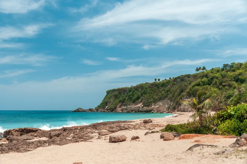
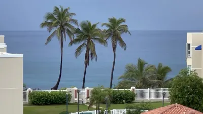
Borinquen Beach is a beach in Aguadilla, Puerto Rico, known for scenic views and surfing. Facilities include parking.
- Scenic
- Surfing
- ✓ Parking
- ✓ Shade/Umbrellas
Road & parking.
The best time to visit is during summer months at low tide when sea conditions allow safe access to hidden cav…
Exercise extreme caution when swimming due to strong Atlantic currents and dangerous undercurrents, especially during winter months.
Swim with a buddy and know your limits.
Free ample parking is available at the beach entrance, though spaces can be limited during busy periods. Access is via Road 107, across from the airport runway through a road that cuts across the golf course.
Ways to experience Borinquen Beach
Bookable tours and activities at and around this beach.
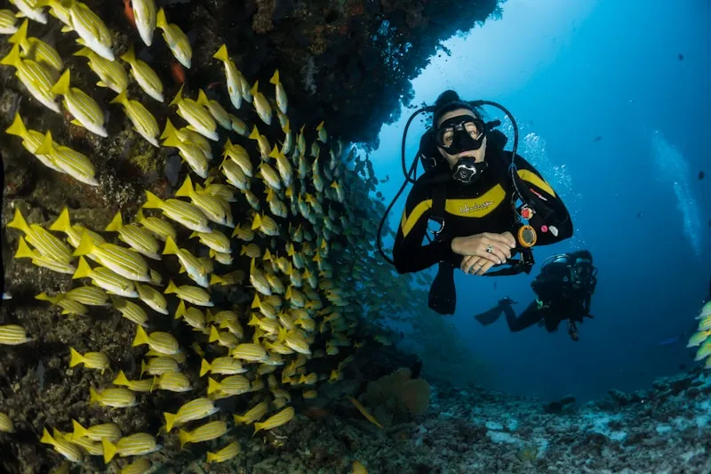
 Viator photoPopular near this beachAguadilla Tropical SnorkelingWe both love spending time in the ocean, that being surfing, bodysurfing, scubadiving, and swimming keeping safety our #1 priority, in order to have…◷ About 2 hours✓ Free cancellationFrom $98Check availability ↗Browse more tours on Viator ↗
We may earn a commission when you book through Viator links, at no extra cost to you.
About Borinquen Beach
Borinquen Beach is a stunning stretch of white sand beach in Aguadilla, perfect for picnics, photography, and exploring dramatic rock formations. This scenic beach offers wide open spaces on both sides of the parking area, with historic lighthouse ruins nearby and beautiful views of turquoise waters against towering cliffs. It's ideal for beachcombers, photographers, and families seeking a peaceful retreat away from crowds.
Local tips
What to Bring+
Camera Equipment:
- A camera is the most important item for Borinquen Beach; the rock formations, cliffs, and lighthouse ruins offer some of the best coastal photography on the island.
- Wide-angle lens to capture the scale of the cliff faces.
- Telephoto lens useful for isolating details in the eroded rock patterns.
- Polarizing filter to help manage glare off the water for landscape shots.
Sun and Water Protection:
- Reef-safe sunscreen (SPF 50 or higher) is a must, as shade is limited along much of the beach. Reapply frequently.
- Hat with a chin strap is practical given the steady coastal winds.
- Water shoes or sturdy sandals with ankle straps are recommended for walking among the rock formations; limestone can be sharp and slippery with algae.
Food and Drink:
- Water and snacks – pack your own, as there are no food vendors directly at the beach. The nearest reliable food options are about a ten-minute drive away.
- Cooler with drinks and sandwiches allows you to spend a full morning or afternoon without needing to leave.
- Trash bag to carry out everything you bring in; this beach has no regular maintenance crew.
History & Background+
Borinquen Beach lies along the northwestern coast of Aguadilla, a municipality with one of the most layered histories on the island. The beach's name derives from Borinquén, the Taíno name for Puerto Rico itself, reflecting the deep indigenous connection to this land. The Taíno people inhabited this coast for centuries before Spanish colonization, and archaeological evidence throughout the Aguadilla area, including ceramic shards, stone tools, and remnants of batey (ceremonial ball courts), confirms their sustained presence.
Aguadilla was founded in 1775 by Luis de Córdova, though European settlement in the area predates the municipality's formal establishment. Spanish explorers first made contact with Taíno communities in this region as early as 1493 during Columbus's second voyage. The name Aguadilla reportedly comes from the Spanish practice of collecting fresh water from springs near the coast, "agua" meaning water, as ships provisioned before continuing their journeys.
The cliffs and rock formations that frame Borinquen Beach are part of a distinctive geological feature of northwestern Puerto Rico. These limestone formations, shaped by millennia of wave action and weathering, create dramatic backdrops of eroded sea stacks and arched rock walls. The geological processes visible here are directly related to the same karst topography that created the famous cave systems of the island's northern interior.
Near the beach stand the remnants of the Punta Borinquen lighthouse, originally constructed in 1889 during the final years of Spanish colonial rule. The lighthouse was severely damaged by the 1918 earthquake, a 7.1 magnitude event that struck the Mona Passage and generated a tsunami that devastated Aguadilla's coastline. During the twentieth century, the area was transformed by the establishment of Ramey Air Force Base in 1939, which operated as a Strategic Air Command installation during the Cold War. The base closed in 1973, and its infrastructure was converted into the Rafael Hernández Airport, residential communities, and public recreation areas. Today, Borinquen Beach serves as a gathering point for local families and photographers, retaining a quieter character compared to Aguadilla's more developed beaches.
Nearby Attractions+
Borinquen Beach is surrounded by interesting attractions within a short drive, offering diverse activities for a full day in the Aguadilla area.
- Punta Borinquen Golf Club, located along the access road to the beach, occupies the grounds of the former Ramey Air Force Base golf course. The 18-hole course offers ocean views from several holes with significantly lower green fees than resort courses elsewhere on the island.
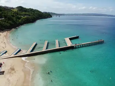
- Crash Boat Beach (Playa Crashboat), about fifteen minutes south in Aguadilla, is one of Puerto Rico's most popular swimming and snorkeling beaches. The beach takes its name from the rescue boats once stationed there during the Ramey Air Force Base era. The concrete pier is a local landmark, and food kiosks along the beach serve fried snacks and cold drinks.
- Aguadilla's Parque de Colón downtown, roughly ten minutes from the beach, features a historic plaza with colonial-era architecture and several restaurants serving local cuisine. El Meson Sandwiches, a Puerto Rican fast-food chain that started in Aguadilla, has its original location nearby.
- The Aguadilla Ice Skating Arena, an unexpected attraction in tropical Puerto Rico, is one of the few Olympic-sized ice rinks in the Caribbean. It is located on the former base grounds, about five minutes from the beach.
- Survival Beach, accessible via a short hike along the cliffs north of Borinquen, offers a more secluded cove setting with dramatic cliff walls on three sides. The trail requires moderate fitness and appropriate footwear.
Photos
Be the first to add a photo
Recent photos help others recognize the access point, water, and parking setup.
Reviews
No Puerto Rico Beach Finder reviews yet
Share whether access was easy, how the water felt, and what the next person should know.
Planning your visit
Explore by activity
Nearby beaches

Questions
Where is Borinquen Beach located?
Borinquen Beach is located in Aguadilla, Puerto Rico. The exact coordinates are 18.4906436, -67.1557946. You can use GPS navigation or follow signs to Aguadilla and look for beach access points.
Is Borinquen Beach good for swimming?
Yes, Borinquen Beach is a public beach open for swimming. Note that this beach is known for surfing conditions, so waves can be strong.
What facilities are available at Borinquen Beach?
Borinquen Beach offers the following facilities: Parking, Shade Structures.
What activities can I do at Borinquen Beach?
Popular activities at Borinquen Beach include swimming, surfing. The beach is perfect for a day trip from Aguadilla.
Is there parking at Borinquen Beach?
Yes, Borinquen Beach has parking available.
Similar beaches
Discover more beaches
Explore 400+ beaches across the island with filters, maps, and detailed guides.
Explore all beaches