Cerro Gordo West Point Vega Alta, Puerto Rico
Quick Facts
About Cerro Gordo West Point
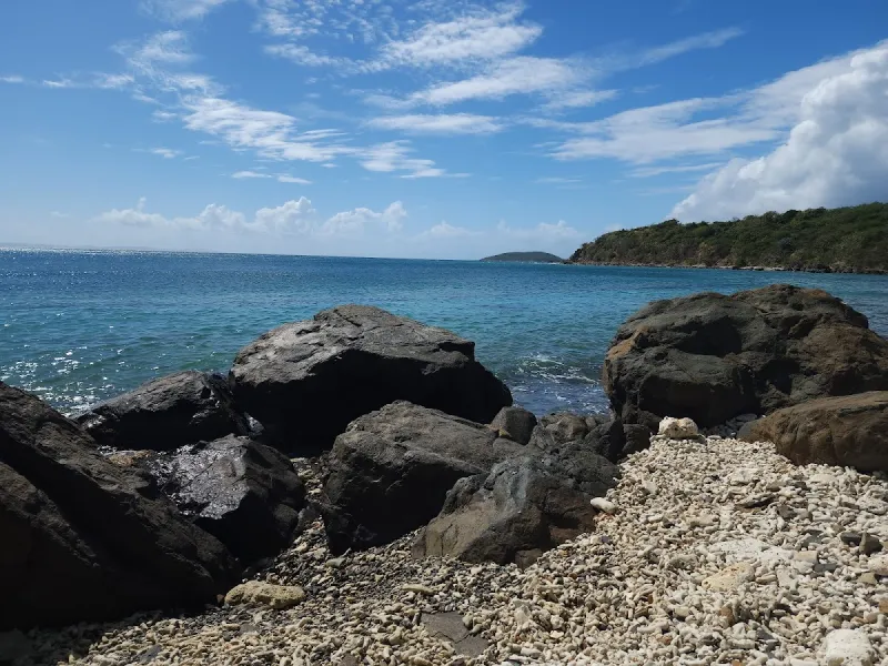
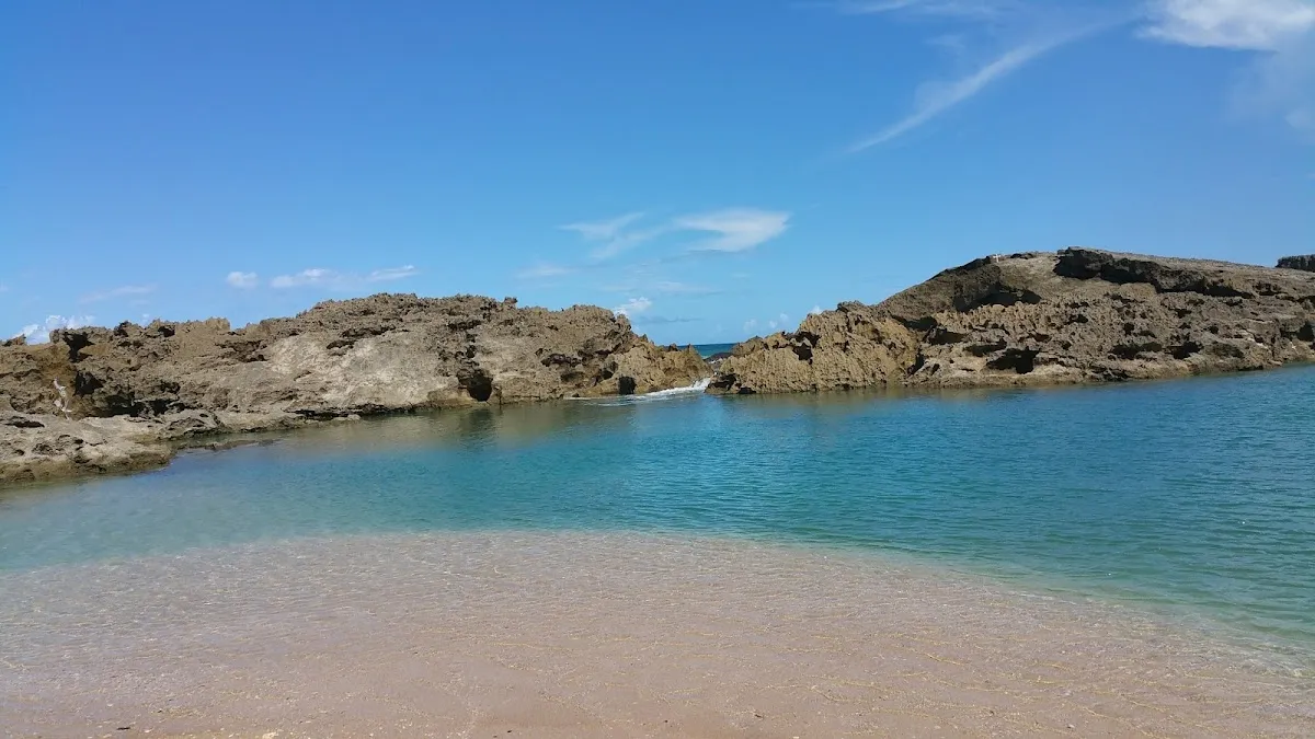
Cerro Gordo West Point is a rocky promontory in Vega Alta on Puerto Rico's north-central coast, roughly 30 minutes west of San Juan. This scenic snorkeling destination features exposed rock shelves, tidal pools, and pockets of clear water on calm days, home to reef fish, corals, and sea fans. The rugged terrain requires water shoes and caution due to strong surge during Atlantic swell periods. Best visited during summer months when conditions are calmest.
Visitor Tips
- Arrive before 10am to secure the best parking spots and beach locations
- Golden hour (shortly after sunrise or before sunset) provides the best lighting for photos
- Bring your own snorkeling gear for the best fit and visibility
- Bring your own food and drinks - limited vendors in the area
- Help preserve the beach beauty by taking all trash with you when you leave
- Bring plenty of water - staying hydrated in the tropical heat is essential
History & Background
Cerro Gordo West Point sits at the western edge of the Cerro Gordo public beach complex in Vega Alta, a municipality on Puerto Rico's north-central coast roughly thirty minutes west of San Juan. The point itself is a rocky promontory that extends into the Atlantic, creating a natural boundary between the main Cerro Gordo beach to the east and a more rugged, less-visited stretch of coastline to the west. Unlike the sandy, family-oriented main beach, the West Point area is characterized by exposed rock shelves, tidal pools, and scattered pockets of sand between coral-encrusted boulders.
Vega Alta was founded in 1775 as a separate municipality from neighboring Vega Baja. The town's economy centered on sugar cane cultivation in the fertile lowlands south of the coast, with the shoreline serving primarily as a fishing area for local families. In the 1970s and 1980s, Puerto Rico's government invested in developing public beach facilities through the Compañía de Parques Nacionales, transforming Cerro Gordo into one of the north coast's most accessible public beaches. The West Point, however, remained largely undeveloped due to its rocky terrain.
The underwater environment includes encrusting corals, sea fans, fire coral, and reef fish including sergeant majors, parrotfish, and blue tangs. Sea urchins are abundant in rock crevices, indicating reef health but posing a practical concern for visitors. The north shore receives direct North Atlantic swells from fall through spring, making the West Point dangerous during periods of elevated swell, as surge channels between rocks can trap or push swimmers against hard surfaces.
Best Time to Visit
Calm ocean conditions are the single most important factor for visiting Cerro Gordo West Point safely and enjoyably. The north coast receives the brunt of Atlantic swells, and the rocky shoreline becomes dangerous when waves are running. The best windows occur during summer months (May through August), when north swells are typically at their annual minimum.
- Summer (May–August): Optimal conditions with minimal north swells and predictable calm spells lasting days at a time. Morning visits provide the best snorkeling visibility before afternoon wind picks up.
- Winter (December–April): Can have calm spells between swell events, but windows are less predictable. Check surf forecasts regularly for workable conditions (anything under three feet from north or northwest).
- Weekday mornings: Visit by 8:00 or 9:00 a.m. for two to three hours of good conditions before wind shifts and crowds arrive. Weekdays are significantly less crowded than weekends.
- Avoid holiday weekends: The main Cerro Gordo beach draws large crowds from the metro area, and parking may reach capacity by 10:00 a.m.
Getting There
From San Juan, Cerro Gordo West Point is approximately 30–40 minutes away via Route 22 West (the José de Diego Expressway, a toll road) toward Vega Alta. Exit at the Vega Alta/Cerro Gordo exit and follow signs north toward the coast. Local road Route 690 leads directly to the Cerro Gordo beach complex.
- Take Route 22 West from the San Juan metro area toward Vega Alta.
- Exit at the Vega Alta/Cerro Gordo exit and follow coastal signs northward.
- Continue on Route 690 to reach the main Cerro Gordo beach parking lot.
- Walk west along the main beach toward the rocky point; the transition from sand to rock happens gradually over about 200 yards.
Parking: The Cerro Gordo public beach has a large parking lot managed by the National Parks Company. A small entrance fee may be charged on weekends and holidays. There is no separate parking area for the West Point specifically. Alternatively, you can continue past the main entrance on Route 690 and look for informal pullover spots near the coast, though the main parking lot is more reliable.
From Dorado, the drive is about 15 minutes east along Route 693. From Manatí or Barceloneta to the west, it's roughly 20 minutes via Route 2 and Route 690.
What to Bring
Essential Protection:
- Water shoes with thick soles are non-negotiable. The rocks are rough, covered in algae, and sea urchins occupy nearly every crevice. Booties designed for reef walking offer the best protection.
- Reef-safe sunscreen and reapply often. The rocky terrain lacks shade, and you'll be exposed to direct sun.
- Hat and sunglasses for your time on the rocks between swims.
Snorkeling Gear:
- Mask, snorkel, and fins are essential for underwater viewing. Fins help you navigate surge and currents near rock formations.
- Rash guard protects against scrapes from rocks and fire coral.
- Reef gloves add an extra layer of hand protection.
Safety and Supplies:
- Drinking water and snacks in a small backpack (food vendors are a 10-minute walk away).
- First aid kit with tweezers (for urchin spines), antiseptic, and adhesive bandages.
- Vinegar in a small bottle can help with urchin spine removal.
- Dry bag to keep your phone and valuables safe from spray.
Nearby Attractions
The immediate area offers diverse attractions for a full day of coastal exploration and cultural immersion.
- Cerro Gordo Beach (Main Beach) – Immediately east of the West Point, featuring a wide sandy beach with lifeguards (weekends), restrooms, showers, picnic shelters, and food kiosks. One of the north coast's best family beaches when conditions are calm.
- Dorado (15 minutes east) – Home to the Dorado Beach Resort (Ritz-Carlton Reserve) with the Positivo Sand Bar restaurant open to non-guests for beachfront dining, and the Museo y Centro Cultural Casa del Rey, a restored eighteenth-century building chronicling the town's sugar cane heritage.
- Cibuco River (Vega Alta) – Supports kayaking and paddleboarding excursions through mangrove-lined channels. Guided tours explore the river's ecosystem, including manatees, kingfishers, and mangrove crabs.
- Cueva del Indio (Manatí, west) – Archaeological site with Taíno petroglyphs carved into limestone cliffs overlooking the ocean. Includes a short walking trail along the cliff edge.
- Arecibo Lighthouse and Historical Park (further west) – Family-oriented attraction with ocean views, a small aquarium, and replica pirate ships.
Local Tips
- Check the swell forecast before entering the water. The West Point looks inviting on calm days but turns treacherous when waves are running. Surge pushes through channels between rocks with enough force to knock you off your feet. If you see whitewater breaking over the outer rocks, stay on dry land.
- Snorkel with a buddy. The best snorkeling pockets are on the east-facing side of the point, where rock formations create a partial barrier against westward currents. Stay within sight of your companion and maintain distance from rocks to avoid being pushed into them by wave action.
- Watch for sea urchins constantly. The long-spined black urchin is abundant and its spines can penetrate water shoes. Shuffle your feet on submerged rocks rather than stepping down hard. If you get a spine embedded, use hot water immersion and careful extraction with tweezers.
- Arrive early to secure parking. Parking can fill up by 10:00 a.m. on summer weekends and holidays. The national parks company may turn away cars when capacity is reached. Visit on weekdays for fewer crowds or bring cash for the food kiosks if you arrive during busy times.
- Explore roadside food stands after your visit. Look for chinchorreo-style spots along Route 690 serving mofongo, tostones, and fried seafood for a genuine local dining experience.
Visitor Photos
Sign in to addNo photos yet. Be the first to share!
Reviews
No reviews yet. Be the first to share your experience!
Conditions
5 months agoLive Updates
No recent crowd data
Amenities
Practical Info
No lifeguards are present. Swim at your own risk and never swim alone. Apply waterproof sunscreen regularly - the tropical sun is strong. Check weather conditions before visiting, especially during hurricane season (June-November).