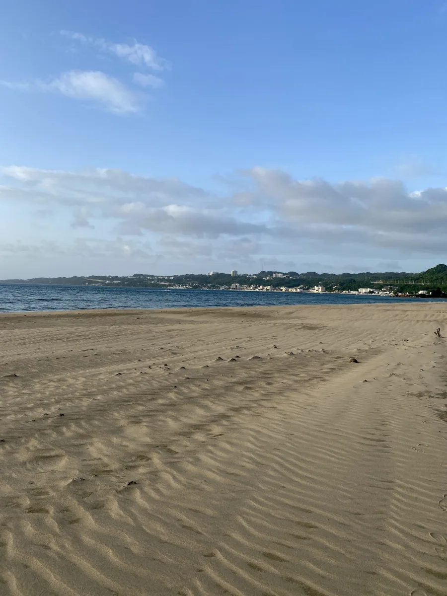
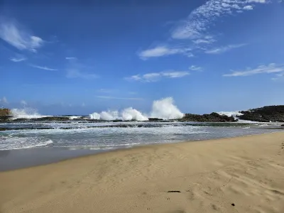
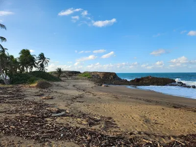
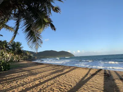
Playa Espinar is a beach in Aguadilla, Puerto Rico, known for scenic views and surfing. A 760-meter beach in Aguadilla on Puerto Rico's northwest coast, bordered by an endangered red mangrove ecosystem that serves as a natural flood barrier for the Culebrinas River estuary. Facilities include parking.
Best for
- Fishing
- Scenic
- Surfing
Amenities
- ✓ Parking
- ✓ Water Sports
Getting there
Short path. Informal roadside parking along the access road with space for about 20 cars. No paved lot or fees. The area near the beach entry can get muddy after rain, so park on higher ground if it has been wet recently.
Best time
Surf season runs from October through March when consistent north and northwest swells reach Aguadilla's coast. Summer months are calmer and better suited for paddleboarding and swimming near the shoreline. Early mornings before 8 AM typically have the cleanest wave faces and lightest winds. The rainy season from August to November can muddy the water near the river mouth after heavy rains.
Beach Score
rates for a day out
Conditions today
Where it is
Ways to experience Playa Espinar
Handpicked recommendations based on access, location and activities.
 Viator photoPopular near this beachAguadilla Tropical SnorkelingWe both love spending time in the ocean, that being surfing, bodysurfing, scubadiving, and swimming keeping safety our #1 priority, in order to have…◷ About 2 hoursFrom $98★ 5.0 (30)View on Viator ↗Rincón & west coast adventuresSurf lessons, Tres Palmas snorkeling, horseback rides and sunset sails.Browse tours ↗
We may earn a commission when you book through Viator links, at no extra cost to you.
About Playa Espinar
A 760-meter beach in Aguadilla on Puerto Rico's northwest coast, bordered by an endangered red mangrove ecosystem that serves as a natural flood barrier for the Culebrinas River estuary. Known for consistent Atlantic swells attracting surfers and paddleboarders, with scenic river-meets-ocean views and diverse birdlife. Limited amenities and informal parking; ideal for experienced water sports enthusiasts and nature lovers.
Local tips
Best Time to Visit+
Playa Espinar offers distinct seasonal conditions suited to different activities and experience levels.
- October through March (Surf Season): Consistent north and northwest swells reach the coast; best for surfing and paddleboarding. Winter months (November–March) deliver the most reliable conditions.
- Summer (June–September): Calmer waters better suited for swimming and snorkeling near the shoreline.
- Early mornings before 8 AM: Cleanest wave faces and lightest winds for all water sports.
- Dry season (January–April): Clear skies provide the most vivid sunsets year-round.
- August–November (Rainy season): Heavy rains can muddy water near the river mouth; plan accordingly.
What to Bring+
Essentials for All Visitors:
- Reef-safe sunscreen (SPF 30 or higher)
- Reusable water bottle filled with fresh water
- Hat or visor for sun protection (10 AM–2 PM is peak intensity)
- Portable beach umbrella or pop-up shade tent (natural shade is limited)
- Cooler with meals, snacks, and water (no food vendors nearby)
- Trash bag for packing out all waste
For Fishing:
- Fishing rod and tackle
- Bait and cooler for your catch
- Valid Puerto Rico fishing license
For Surfing & Paddleboarding:
- Surfboard (shortboard or longboard depending on conditions; no rentals at beach)
- Rash guard and surf wax
- Reef boots if bottom is rocky
- Paddleboard (bring your own)
For Photography:
- Camera with extra battery
- Tripod for sunset shots
- Binoculars for coastal views and birdlife
Safety Note: No lifeguards are stationed at Playa Espinar. River mouth currents are unpredictable; swim away from the river channel and avoid the water after heavy rains when runoff increases. Surfers should be comfortable in open-ocean swells.
History & Background+
Playa Espinar is located in Aguadilla, a northwest coast municipality with deep ties to Ramey Air Force Base and Puerto Rico's military heritage. Positioned on the northwest corner of Puerto Rico, this area captures both north Atlantic swells and energy from the Mona Passage, creating consistent conditions for water sports.
The 760-meter beach is bordered by a mangrove ecosystem featuring endangered red mangrove species, which serves as a natural flood barrier and supports diverse birdlife along the Culebrinas River estuary. Where freshwater marsh and saltwater coast converge, the landscape reflects the ongoing relationship between coastal communities and the sea, whether visited by local families on weekends or travelers discovering the area for the first time.
Nearby Attractions+
Playa Espinar is situated in Aguadilla, which offers numerous attractions and dining options beyond the beach itself. The area is known for fresh seafood and traditional Puerto Rican cuisine at informal establishments.
- Crash Boat Beach – nearby popular beach worth a visit if you have extra time
- Punta Borinquen Lighthouse – scenic coastal landmark near Crash Boat
- Isabela – neighboring area worth exploring, a short drive away
- Canto Las Piedras Beach – alternative beach in Aguadilla with different character
- Wilderness Beach – nearby option for beach hopping
- Rompeolas Beach – additional coastal spot in the Aguadilla area
- Aguadilla town center plaza – central hub with church, local shops, and cafes; experience everyday Puerto Rican town life
- Local restaurants and chinchorros (roadside kiosks) – serve traditional fare including mofongo, tostones, empanadillas, and bacalaítos; weekend food stalls and festivals (fiestas patronales) feature live music and cultural performances
Local Tips+
- Respect river mouth currents: Avoid swimming directly where the river channel meets the ocean, as currents are unpredictable and shift with tide and rain conditions.
- Follow surf etiquette: Local surfers maintain an informal lineup. Wait your turn, respect the rotation (especially on crowded swell days), do not drop in on other surfers, and give right of way to the person closest to the peak of the wave.
- Optimize photography: The mangrove backdrop and river estuary create interesting compositions. Best light is in the late afternoon facing west.
- Know your beach access rights: The beach zone up to the high-tide mark is public land by law, regardless of any adjacent private property or signage suggesting otherwise. You have the legal right to access and enjoy any beach in Puerto Rico.
- Practice environmental stewardship: Pack out all trash and leave the beach as you found it. Between April and November, sea turtles may nest on sandy beaches; if you spot a nest or hatchlings, keep your distance and report it to the DRNA (Department of Natural Resources).
- Consider hiring a local surf instructor: If new to surfing in Puerto Rico, a local guide can teach specific conditions, reef layout, and hazards at this break.
- Learn basic Spanish: Spanish is the primary language outside San Juan's tourist zones. Simple phrases like '¿Dónde está la playa?' (Where is the beach?) and 'Gracias' (Thank you) show respect and go a long way with locals.
Getting there & safety
Access
Short path. Informal roadside parking along the access road with space for about 20 cars. No paved lot or fees. The area near the beach entry can get muddy after rain, so park on higher ground if it has been wet recently.
Swim smart
No lifeguards are stationed at Playa Espinar. The river mouth creates variable currents that shift with tide and rain conditions. Surfers should be comfortable in open-ocean swells. Non-surfers should swim away from the river channel. Avoid the water after heavy rains when runoff increases.
Help the next person plan this beach
Add recent photos, leave a review, or report today's conditions.
Photos
Be the first to add a photo
Recent photos help others recognize the access point, water, and parking setup.
Community reviews
No Puerto Rico Beach Finder reviews yet
Share whether access was easy, how the water felt, and what the next person should know.
Planning your visit
Explore by activity
Nearby beaches
View location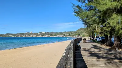


Similar beaches
Questions
Where is Playa Espinar located?
Playa Espinar is located in Aguadilla, Puerto Rico. The exact coordinates are 18.409017, -67.170195. You can use GPS navigation or follow signs to Aguadilla and look for beach access points.
Is Playa Espinar good for swimming?
Yes, Playa Espinar is a public beach open for swimming. Note that this beach is known for surfing conditions, so waves can be strong.
What facilities are available at Playa Espinar?
Playa Espinar offers the following facilities: Parking, Water Sports.
What activities can I do at Playa Espinar?
Popular activities at Playa Espinar include swimming, surfing, fishing. The beach is perfect for a day trip from Aguadilla.
Is there parking at Playa Espinar?
Yes, Playa Espinar has parking available.
What is the best time to visit Playa Espinar?
The best time to visit Playa Espinar is during Puerto Rico's dry season from December to April. For fewer crowds, visit on weekday mornings. For surfing, winter months (November-March) typically have the best swells. Always check weather conditions before visiting.
Discover more beaches
Explore 400+ beaches across the island with filters, maps, and detailed guides.
Explore all beaches