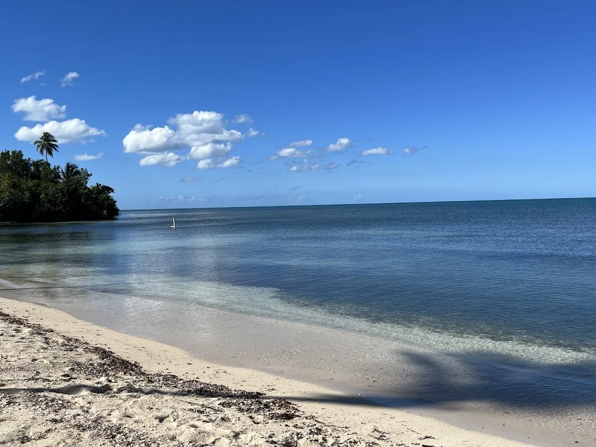
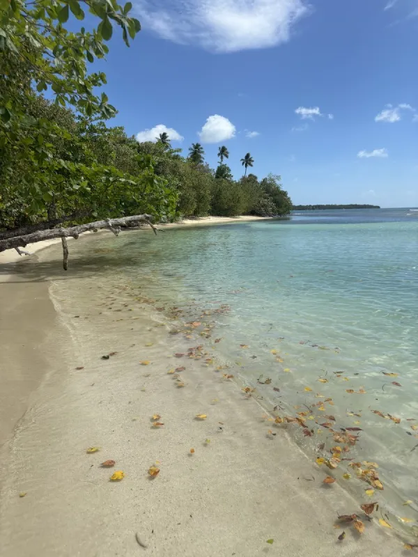
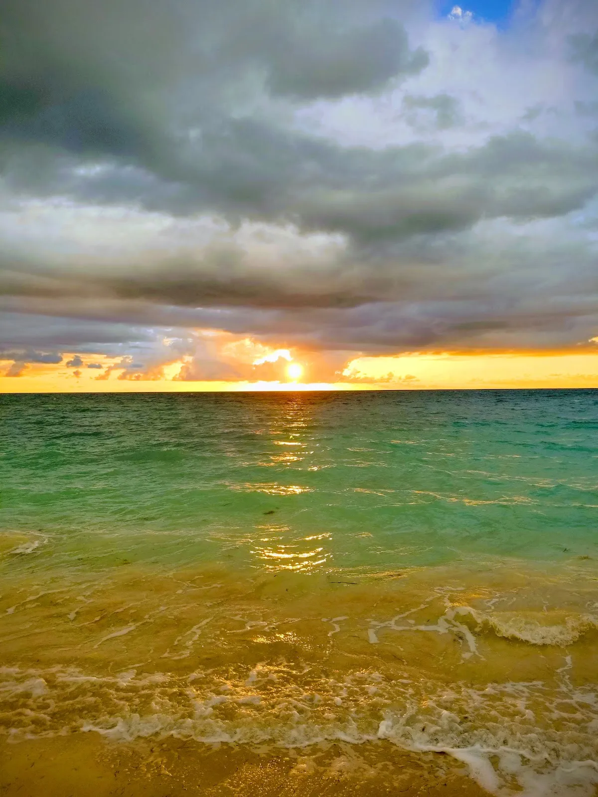
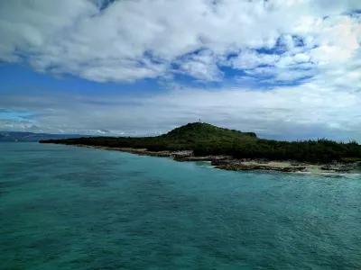
Playa La Mela Cabo Rojo is a secluded beach in Cabo Rojo, Puerto Rico, known for calm waters and scenic views. A serene, secluded beach in Cabo Rojo's La Mela neighborhood, stretching approximately 300 meters of pristine golden sand and turquoise Caribbean waters. Facilities include parking.
Best for
- Scenic
- Secluded
Amenities
- ✓ Parking
- ✓ Shade/Umbrellas
Getting there
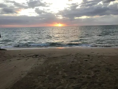
Short path. No formal parking lot exists. Visitors park along the road shoulder near the La Mela community. Space for roughly 10-15 cars. Avoid blocking residential driveways or narrow road sections.
Best time
Visit from December through May for the driest conditions and calmest Caribbean waters. Mornings are best before afternoon trade winds pick up. Weekdays are nearly empty year-round given the beach's low profile among tourists. During the winter dry season the water visibility is at its best, and the nearby salt flats take on vivid pink and orange hues worth exploring.
Beach Score
rates for a day out
Conditions today
Where it is
Ways to experience Playa La Mela Cabo Rojo
Handpicked recommendations based on access, location and activities.
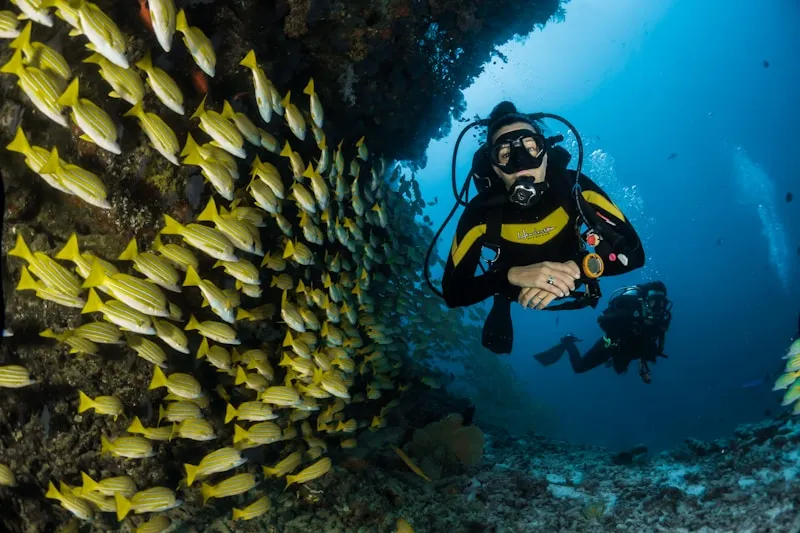
 Viator photoPopular Puerto Rico experienceAguadilla Tropical SnorkelingWe both love spending time in the ocean, that being surfing, bodysurfing, scubadiving, and swimming keeping safety our #1 priority, in order to have…◷ About 2 hoursFrom $98★ 5.0 (30)View on Viator ↗Rincón & west coast adventuresSurf lessons, Tres Palmas snorkeling, horseback rides and sunset sails.Browse tours ↗
We may earn a commission when you book through Viator links, at no extra cost to you.
About Playa La Mela Cabo Rojo
A serene, secluded beach in Cabo Rojo's La Mela neighborhood, stretching approximately 300 meters of pristine golden sand and turquoise Caribbean waters. This natural, undeveloped beach offers calm conditions ideal for swimming, with no formal infrastructure to preserve its quiet, undisturbed character. The nearby Cabo Rojo Lighthouse and scenic coastal trails are within easy reach, making it an excellent stop for those exploring the southwest coast.
Local tips
Best Time to Visit+
Playa La Mela Cabo Rojo offers excellent swimming conditions during specific seasons, with the calmest waters and best weather occurring at particular times of year.
- December through May: Driest conditions with calm Caribbean waters, vivid pink and orange salt flats, and best water visibility. Winter sunsets are spectacular with clear skies.
- Morning hours: Best visited before afternoon trade winds pick up. Visit early to experience the calmest conditions and optimal lighting for photography.
- Weekdays year-round: Nearly empty given the beach's low profile among tourists, offering solitude and a peaceful experience.
- October through April: West coast receives north swells, though this beach remains relatively calm due to its sheltered location.
Due to its secluded nature, this beach rarely experiences significant crowding, even on weekends and holidays.
What to Bring+
Sun and Water Protection:
- Reef-safe sunscreen (SPF 30 or higher) for Puerto Rico's intense tropical sun, especially between 10 AM and 2 PM
- Hat or visor for head protection
- Reusable water bottle for hydration throughout your visit
- Swim gear for the whole family
Food and Sustenance:
- Meals and snacks (no food vendors at or near this beach)
- Cooler with plenty of water to stay hydrated in the heat
- First aid kit with basic supplies, as there are no emergency facilities
Optional but Recommended:
- Camera with extra battery and tripod for sunset photography
- Binoculars for coastal views
- Float or inflatable for lounging on calm waters
- Shade structure (umbrella or pop-up tent) as there are no facilities
Pack everything you need including water, food, and shade. This is an unmonitored beach with no lifeguards, restrooms, or vendor amenities.
History & Background+
Playa La Mela Cabo Rojo is located in the municipality of Cabo Rojo, a southwestern municipality famous for salt flats, the Los Morrillos Lighthouse, and spectacular sunsets. On the southwestern tip of Puerto Rico, this area faces the Caribbean Sea with calm conditions and warm waters year-round. The dry climate creates a landscape distinct from the rest of the island, with salt flats and scrubland meeting the shore.
This small, natural beach in the La Mela neighborhood stretches roughly 300 meters of golden sand with turquoise water. With no formal infrastructure, the beach preserves its quiet, undisturbed character as a local escape. The Cabo Rojo Lighthouse and its surrounding salt flats trail system are within a short drive, making this beach a natural stop on a southwest coast exploration day.
Whether visited by local families on weekends or travelers discovering the area for the first time, Playa La Mela Cabo Rojo reflects the ongoing relationship between coastal communities and the sea, embodying the authentic character of Cabo Rojo's shoreline.
Nearby Attractions+
Playa La Mela Cabo Rojo is situated in Cabo Rojo, which offers several attractions and experiences beyond the beach itself. The area is rich with natural wonders, dining options, and cultural sites worth exploring.
- Los Morrillos Lighthouse and Cabo Rojo Salt Flats: Well worth a visit with scenic trails and vivid mineral-colored water, located a short drive away
- Other Cabo Rojo Beaches: Playa Buye, Playa El Combate, and Joyuda Beach, each with different character for beach hopping adventures
- Cabo Rojo Town Center: Features a central plaza with church, local shops, and cafes—a good place to experience everyday Puerto Rican town life
- Local Restaurants and Kiosks (Chinchorros): Serving traditional Puerto Rican fare including fresh seafood, mofongo (mashed plantain with garlic), tostones (fried plantain slices), empanadillas, bacalaítos (codfish fritters), and piraguas (shaved ice with fruit syrup)
- Weekend Markets and Fiestas Patronales: Many towns hold patron saint celebrations throughout the year featuring live music, food, and cultural performances
Local Tips+
- Photography timing: The turquoise water against golden sand photographs well at mid-morning; afternoon light can be harsh and washed out.
- Swim safety: No lifeguards are present. Swim with a partner and stay close to shore, especially if seas appear rougher than usual. Keep an eye on weather forecasts and be aware that even sheltered areas can develop currents after storms or during unusual tidal patterns.
- Beach access rights: As with all Puerto Rico beaches, the beach zone up to the high-tide mark is public land by law, regardless of any adjacent private property or signage suggesting otherwise. You have the legal right to access and enjoy any beach in Puerto Rico.
- Environmental responsibility: Pack out all trash and leave the beach as you found it. Puerto Rico's coastal ecosystems are under pressure from development and climate change, and responsible visitors make a real difference.
- Sea turtle protection: Between April and November, sea turtles may nest on sandy beaches. If you spot a nest or hatchlings, keep your distance and report it to the DRNA (Department of Natural Resources).
- Language and culture: Spanish is the primary language in most areas outside San Juan's tourist zones. Learning a few phrases like '¿Dónde está la playa?' (Where is the beach?) and 'Gracias' (Thank you) goes a long way with locals. Puerto Ricans are generally warm and helpful toward visitors who show respect for the culture and environment.
Getting there & safety
Access
Short path. No formal parking lot exists. Visitors park along the road shoulder near the La Mela community. Space for roughly 10-15 cars. Avoid blocking residential driveways or narrow road sections.
Swim smart
This is an unmonitored beach with no lifeguards, restrooms, or emergency facilities. The calm Caribbean waters are generally safe for swimming, but there are no posted condition updates. Bring your own first aid supplies and let someone know your plans before visiting.
Help the next person plan this beach
Add recent photos, leave a review, or report today's conditions.
Photos
Be the first to add a photo
Recent photos help others recognize the access point, water, and parking setup.
Community reviews
No Puerto Rico Beach Finder reviews yet
Share whether access was easy, how the water felt, and what the next person should know.
Planning your visit
Explore by activity
Nearby beaches
View location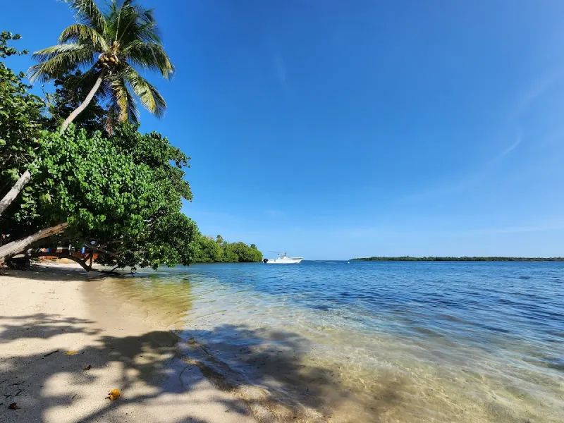

Similar beaches
Questions
Where is Playa La Mela Cabo Rojo located?
Playa La Mela Cabo Rojo is located in Cabo Rojo, Puerto Rico. The exact coordinates are 18.063353, -67.197315. You can use GPS navigation or follow signs to Cabo Rojo and look for beach access points.
Is Playa La Mela Cabo Rojo good for swimming?
Yes, Playa La Mela Cabo Rojo is a public beach open for swimming. The beach has calm waters, making it ideal for swimming.
What facilities are available at Playa La Mela Cabo Rojo?
Playa La Mela Cabo Rojo offers the following facilities: Parking, Shade Structures.
What activities can I do at Playa La Mela Cabo Rojo?
Popular activities at Playa La Mela Cabo Rojo include swimming. The beach is perfect for a day trip from Cabo Rojo.
Is there parking at Playa La Mela Cabo Rojo?
Yes, Playa La Mela Cabo Rojo has parking available.
What is the best time to visit Playa La Mela Cabo Rojo?
The best time to visit Playa La Mela Cabo Rojo is during Puerto Rico's dry season from December to April. For fewer crowds, visit on weekday mornings. Always check weather conditions before visiting.
Discover more beaches
Explore 400+ beaches across the island with filters, maps, and detailed guides.
Explore all beaches