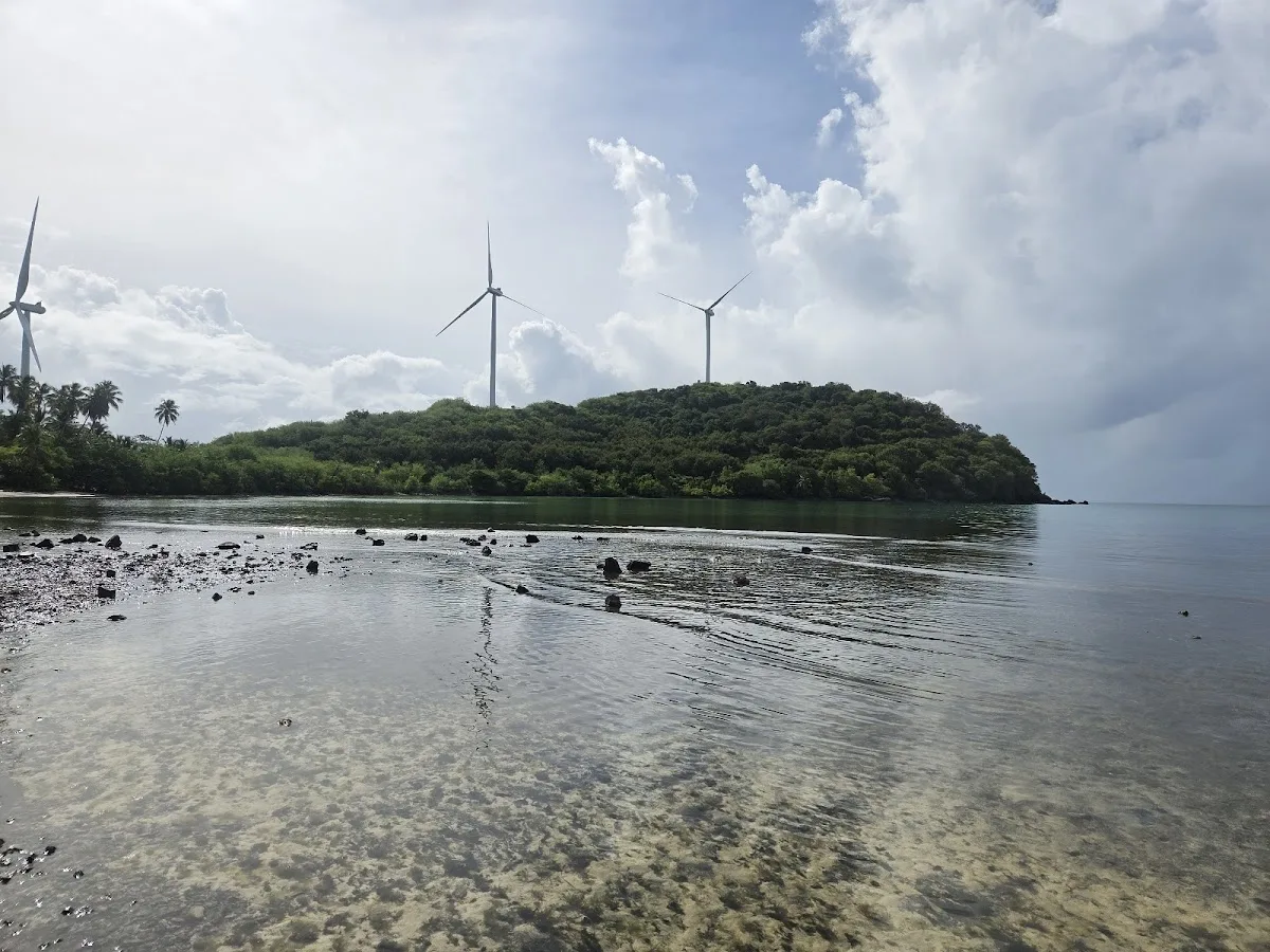
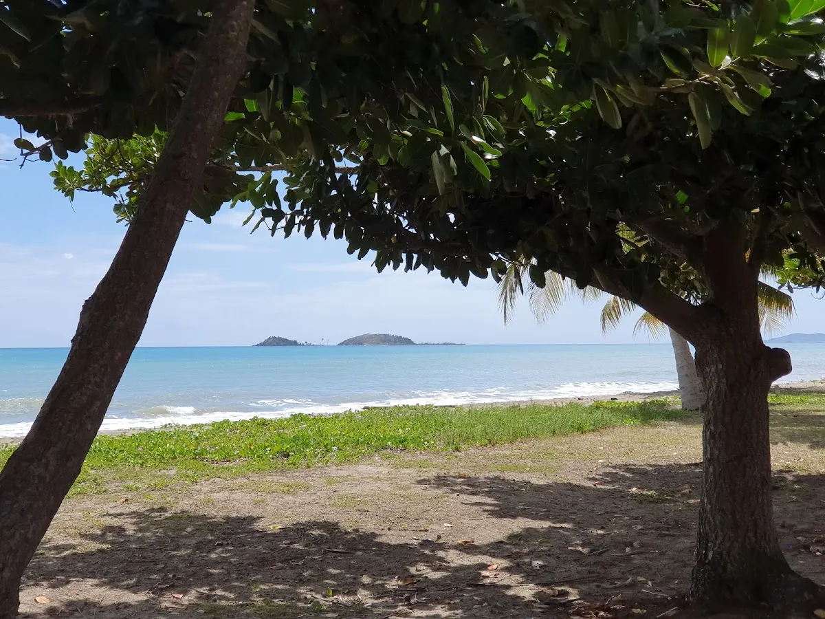
Bahía Lima Beach is a secluded beach in Naguabo, Puerto Rico, known for scenic views and its secluded atmosphere. A secluded coastal area in northern Naguabo near Punta Lima, bordered by dense mangrove forest and offering scenic views of offshore cays and Monkey Island. Facilities include parking.
- Fishing
- Scenic
- Secluded
- ✓ Parking
10-min walk.
The east coast is driest from January through April, making these months best for visiting.
10-min walk.
The rugged shoreline is not suitable for swimming. Sharp rocks and uneven terrain present trip and cut hazards.
Swim with a buddy and know your limits.
Limited informal roadside parking near the Punta Lima area. Space for roughly 5-8 vehicles. No marked lot, signs, or fees. The access point is not well advertised, so use GPS coordinates to find it.
Bring water, shade, and food for the day.
Ways to experience Bahía Lima Beach
Bookable tours and activities at and around this beach.
 Viator photoPopular near this beachPrivate: Piñones Beach Buggy Adventure + El Yunque WaterfallsCelebrate unforgettable moments on a private tour exclusively for you and your group, with personal attention from your dedicated guide. Start your…◷ About 6 hours✓ Free cancellationFrom $265Check availability ↗Browse more tours on Viator ↗
We may earn a commission when you book through Viator links, at no extra cost to you.
About Bahía Lima Beach
A secluded coastal area in northern Naguabo near Punta Lima, bordered by dense mangrove forest and offering scenic views of offshore cays and Monkey Island. The rugged, rocky shoreline appeals to explorers and photographers rather than traditional swimmers, with tidal pools and rocky outcrops revealing rich marine life. Accessible by a short walk from limited roadside parking, this quiet fishing spot rewards early morning visits with calm waters and abundant wildlife.
Local tips
What to Bring+
Sun and Water Protection:
- Reef-safe sunscreen (SPF 30 or higher) – Puerto Rico's tropical sun is intense, especially between 10 AM and 2 PM
- Reusable water bottle with plenty of drinking water in a cooler
- Wide-brimmed hat for sun protection
- Portable beach umbrella or pop-up shade tent – natural shade is limited
For Fishing:
- Fishing rod and tackle
- Bait suitable for local fish species
- Cooler for storing your catch
- Valid Puerto Rico fishing license
For Photography and Wildlife Viewing:
- Camera with extra batteries
- Tripod for sunset or landscape shots
- Binoculars for coastal views and bird watching
Safety and Navigation:
- Sturdy, closed-toe footwear – essential for navigating the rocky, uneven shoreline. This is not a barefoot-friendly beach
- First aid kit – the rugged shoreline presents trip and cut hazards from sharp rocks
- Food and snacks – there are no food vendors at or near this beach
History & Background+
Bahía Lima Beach is located in the municipality of Naguabo on Puerto Rico's eastern coast, where the Atlantic Ocean and Caribbean Sea converge. The east coast serves as a jumping-off point to offshore islands and cays, including Cayo Santiago (Monkey Island), visible from the shore. Trade winds provide steady breezes characteristic of this region.
This quiet coastal area near Punta Lima is bordered by dense mangrove forest that provides critical habitat for wading birds and juvenile fish, creating a rich ecological zone between land and sea. The shoreline is more rugged than sandy, with rocky outcrops and small tidal pools rather than traditional beach terrain. This rugged landscape appeals to visitors who enjoy coastal exploration and discovering marine life in the intertidal zone, reflecting the character of northern Naguabo's working fishing communities.
Nearby Attractions+
Bahía Lima Beach is situated in Naguabo, which offers several attractions worth exploring during your visit to the east coast.
- Cayo Santiago (Monkey Island): Visible offshore from the beach, this island is home to a research colony of rhesus macaques and is well worth a visit if you have extra time and can arrange boat access.
- Nearby beaches: Playa Tropical (Naguabo), Punta Lima Beach, and Tropical Beach Naguabo each offer different character and terrain if you're interested in beach hopping.
- Humacao: A neighboring coastal town a short drive away with additional amenities and attractions.
- Naguabo town center: Features a central plaza with a church, local shops, and cafes – a good place to experience everyday Puerto Rican town life. Weekend markets or festivals occur throughout the year, particularly during fiestas patronales (patron saint celebrations) with live music, food, and cultural performances.
- Local dining: Look for traditional Puerto Rican restaurants and roadside kiosks (chinchorros) serving fresh seafood, mofongo (mashed plantain with garlic), tostones (fried plantain slices), and weekend food stalls selling empanadillas, bacalaítos (codfish fritters), and piraguas (shaved ice with fruit syrup). Ask locals for their favorite spot – the best food is often at the least conspicuous establishments.
Photos
Be the first to add a photo
Recent photos help others recognize the access point, water, and parking setup.
Reviews
No Puerto Rico Beach Finder reviews yet
Share whether access was easy, how the water felt, and what the next person should know.
Planning your visit
Explore by activity
Nearby beaches

Questions
Where is Bahía Lima Beach located?
Bahía Lima Beach is located in Naguabo, Puerto Rico. The exact coordinates are 18.184449, -65.698379. You can use GPS navigation or follow signs to Naguabo and look for beach access points.
Is Bahía Lima Beach good for swimming?
Yes, Bahía Lima Beach is a public beach open for swimming.
What facilities are available at Bahía Lima Beach?
Bahía Lima Beach offers the following facilities: Parking.
What activities can I do at Bahía Lima Beach?
Popular activities at Bahía Lima Beach include fishing. The beach is perfect for a day trip from Naguabo.
Is there parking at Bahía Lima Beach?
Yes, Bahía Lima Beach has parking available.
Similar beaches
Discover more beaches
Explore 400+ beaches across the island with filters, maps, and detailed guides.
Explore all beaches