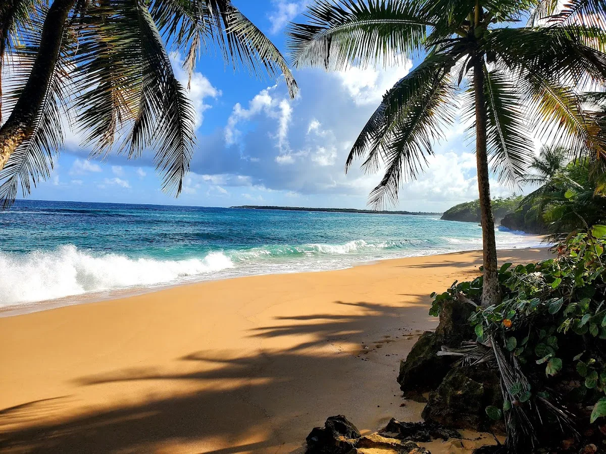
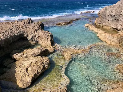
Escondida Beach is a secluded beach in Manati, Puerto Rico, known for scenic views and its secluded atmosphere. A long, undeveloped stretch of sand along Manatí's north coast, about 5 kilometers from town center.
Best for
- Scenic
- Secluded
Amenities
Limited listed — bring what you need
Getting there
10-min walk. Informal roadside pull-off areas along the access road. No paved lot or marked spaces. The area can accommodate several cars but signage is minimal.
Best time
Summer months (June through September) offer the calmest north coast conditions. Winter swells can make the water rough and unsuitable for casual swimming. Early mornings are quietest and coolest. This is a year-round solitude beach since it draws very few visitors regardless of season.
Beach Score
rates for a day out
Conditions today
Where it is
Ways to experience Escondida Beach
Handpicked recommendations based on access, location and activities.
 Viator photoPopular near this beachSan Juan Guided Snorkeling Experience - With Transport 8am or 3pmDon't let other companies fool you! Transportation, entrance fees and gear are included in our price! Book with us, save money and feel relief!…From $89★ 4.3 (61)View on Viator ↗North coast caves & adventuresCueva del Indio, cave tubing, waterfalls and eco tours near Arecibo.Browse tours ↗
We may earn a commission when you book through Viator links, at no extra cost to you.
About Escondida Beach
A long, undeveloped stretch of sand along Manatí's north coast, about 5 kilometers from town center. Named for its hidden character, Escondida Beach combines dense coastal vegetation with turquoise Atlantic waters. No amenities or lifeguards, preserving its natural landscape. Ideal for visitors seeking solitude and unspoiled coastline, though swimming requires caution due to ocean conditions.
Local tips
Best Time to Visit+
The dry season months of January through April offer the most reliable conditions for Escondida Beach. Rain is less frequent, the coastal vegetation is less overgrown, and the north coast surf tends to be moderate enough for swimming on calmer days.
- Summer months (May–August) bring warmer water but also more frequent afternoon rain showers, higher humidity, and increased mosquito populations along the vegetated path.
- Morning hours (8–10 AM) are ideal for visiting, providing maximum daylight and calmer conditions before afternoon trade winds develop.
- Weekdays are almost always quiet, with the beach sometimes entirely empty. Weekends bring a handful of local visitors from Manatí and Vega Baja, but crowds remain minimal.
- Timing and daylight matter significantly here—arriving early ensures you have the full day and avoids being caught at an unserviced beach location as light fades.
What to Bring+
Self-sufficiency is the operating principle here. Bring everything you need and plan to carry everything back out.
- Water: At least two liters per person. There is no drinking water available, and the combination of sun, salt air, and walking through vegetation dehydrates faster than expected. Freeze water bottles the night before to serve double duty as ice packs and cold drinking water as they thaw.
- Food: Packed food is essential. The nearest restaurants or convenience stores are back in the Manatí town area, about a 15-minute drive. Sandwiches, fruit, and energy bars in a small cooler work well.
- Bug spray: Apply before starting the walk through the coastal vegetation to the sand. The mangrove and sea grape thickets along the path harbor mosquitoes year-round, with peak activity at dawn and dusk.
- Sunscreen: Reef-safe sunscreen rated SPF 50 or higher is necessary for the beach itself, where shade is extremely limited.
- First aid kit: A basic first aid kit is prudent for any unserviced beach. Include adhesive bandages, antiseptic, and any personal medications. Cell phone reception can be spotty in this area, so do not count on being able to call for help immediately in an emergency.
- Trash bags: Bring two—one for trash and one as a ground cloth for your gear on the sand. Leave the beach cleaner than you found it.
History & Background+
Escondida Beach, cuyo nombre se traduce como "playa escondida", se encuentra a lo largo de la costa norte de Manatí, un municipio cuya historia se remonta a los primeros siglos de la colonización española. Manatí fue fundado oficialmente en 1738, aunque los colonos españoles habían estado cultivando los fértiles valles fluviales del área desde principios del 1600. El nombre del municipio probablemente deriva del manatí, el mamífero marino que una vez habitó los estuarios y aguas costeras del norte de Puerto Rico en números mayores que los de hoy.
La franja costera donde se encuentra Escondida Beach fue históricamente parte de los vastos ingenios azucareros que dominaron la economía de Manatí desde el período colonial hasta mediados del siglo XX. La producción de azúcar definió casi todos los aspectos de la vida en los municipios de la costa norte; las llanuras costeras planas proporcionaban condiciones ideales para el cultivo, y las instalaciones portuarias a lo largo de la orilla norte enviaban azúcar crudo y melaza a mercados en España, Estados Unidos y Europa. El colapso de la industria azucarera en los años 1960 y 1970 dejó gran parte de esta tierra agrícola costera abandonada, y la vegetación gradualmente reclamó las zonas amortiguadoras entre los campos de caña y el mar.
Este proceso de renaturalización es parte de lo que le da carácter a Escondida Beach hoy. La vegetación costera, uvas de mar, cocoteros y varias especies de arbustos tolerantes a la sal, ha crecido sin control durante décadas, creando un denso borde verde entre los caminos de acceso y la arena. La cualidad "escondida" de la playa no es una invención de marketing; la vegetación genuinamente oculta la playa de la carretera y las áreas circundantes, y los visitantes por primera vez a veces pasan por los puntos de entrada sin darse cuenta de que la playa está allí.
Nearby Attractions+
Several notable attractions are located within a short drive of Escondida Beach, offering diverse experiences along Puerto Rico's north coast.
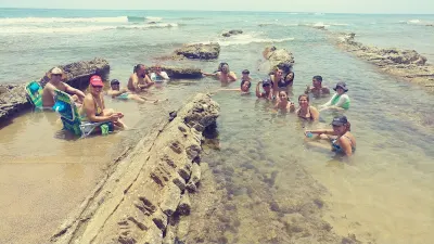
- Playa Mar Chiquita (about 10 minutes west along the coast road) is one of Puerto Rico's most photographed beaches. The distinctive rock formation creates a nearly enclosed cove where ocean water enters through a narrow channel, creating a natural swimming pool effect. The visual contrast of the open Atlantic beyond the rock walls makes it a popular photography and social media destination.
- Hacienda La Esperanza (about 15 minutes away in Manatí) is a nature reserve managed by the Conservation Trust of Puerto Rico. It preserves a 19th-century sugar plantation with restored buildings, a steam engine, and extensive trails through coastal and lowland forest habitats. Guided tours explain the agricultural and slavery history of the site.
- Cueva del Indio (in Arecibo, about 25 minutes west) offers dramatic karst limestone formations with Taíno petroglyphs in a sea cave. The geological contrast with Escondida's sandy stretch highlights the diversity of Puerto Rico's north coast.
- Plaza de Recreo (in Manatí town) has several local restaurants serving traditional Puerto Rican dishes. The bakeries in town produce freshly baked pan sobao (a soft, slightly sweet bread) that is a regional staple worth trying.
Local Tips+
- Tell someone where you are going: This is an unserviced, relatively isolated beach with limited cell reception. Basic safety planning is important when visiting remote coastal areas without lifeguards or other visitors nearby.
- Swim with extreme caution: The north coast of Puerto Rico faces the open Atlantic, and rip currents are common along this stretch. There are no lifeguards and no warning flag systems. If you are not a confident ocean swimmer, limit yourself to wading in the shallows. Never swim alone.
- Access paths change over time: The paths change over time as vegetation grows, storms reshape the coast, and foot traffic creates new routes. What you find on a map or in older directions may not match current conditions. Be prepared to explore a bit to find the best path through to the sand.
- Do not leave valuables in your car: The parking situation, an unmarked roadside pulloff, offers no security. Take your wallet, phone, and keys with you to the beach in a waterproof bag.
- Afternoon winds are strong: Manatí's north coast is known for strong afternoon onshore winds. If you plan to spend the full day, be aware that sand gets airborne in the late afternoon, making conditions less comfortable. The morning hours, typically before noon, offer calmer conditions.
- Help maintain the undeveloped character: The undeveloped character of this beach is its defining feature. Help maintain it by packing out all trash and avoiding any activity that damages the coastal vegetation. The dense plant cover is what prevents erosion and maintains the beach's sand supply.
Getting there & safety
Access
10-min walk. Informal roadside pull-off areas along the access road. No paved lot or marked spaces. The area can accommodate several cars but signage is minimal.
Swim smart
No lifeguard, no facilities, and no cell service in some spots. North coast Atlantic surf can produce strong currents and shore break. Never swim alone. Watch for rocks submerged in the wave zone near the edges of the beach.
Help the next person plan this beach
Add recent photos, leave a review, or report today's conditions.
Photos
Be the first to add a photo
Recent photos help others recognize the access point, water, and parking setup.
Community reviews
No Puerto Rico Beach Finder reviews yet
Share whether access was easy, how the water felt, and what the next person should know.
Planning your visit
Explore by activity
Nearby beaches
View location


Similar beaches
Questions
Where is Escondida Beach located?
Escondida Beach is located in Manati, Puerto Rico. The exact coordinates are 18.46885, -66.469191. You can use GPS navigation or follow signs to Manati and look for beach access points.
Is Escondida Beach good for swimming?
Yes, Escondida Beach is a public beach open for swimming.
What facilities are available at Escondida Beach?
Escondida Beach is a natural beach. Facilities may be limited, so consider bringing your own supplies.
What activities can I do at Escondida Beach?
Popular activities at Escondida Beach include swimming. The beach is perfect for a day trip from Manati.
Is there parking at Escondida Beach?
Parking near Escondida Beach may be limited. It's recommended to arrive early, especially on weekends and holidays.
What is the best time to visit Escondida Beach?
The best time to visit Escondida Beach is during Puerto Rico's dry season from December to April. For fewer crowds, visit on weekday mornings. Always check weather conditions before visiting.
Discover more beaches
Explore 400+ beaches across the island with filters, maps, and detailed guides.
Explore all beaches