Fuerte Caprón Guanica, Puerto Rico
At a Glance
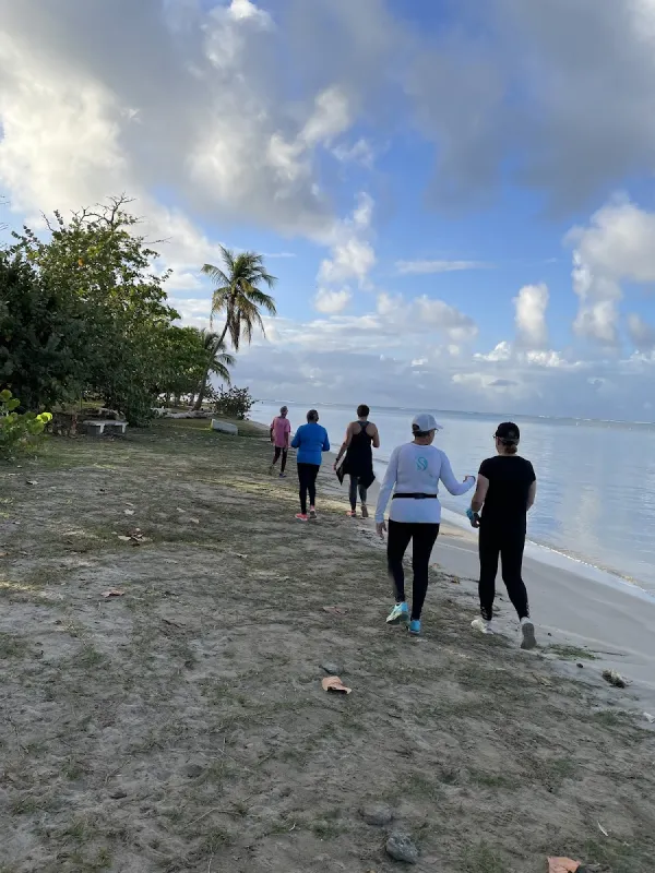
Fuerte Caprón is a secluded beach in Guanica, Puerto Rico, known for scenic views and its secluded atmosphere. Rocky coastal stretch below the ruins of a 16th-century Spanish fortress in Guánica's arid dry forest.
About Fuerte Caprón
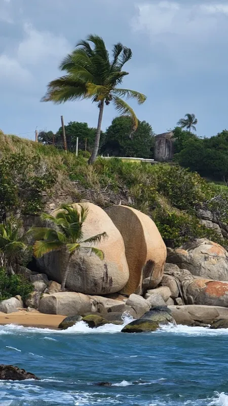
Rocky coastal stretch below the ruins of a 16th-century Spanish fortress in Guánica's arid dry forest. A short but steep trail from PR-333 leads to the hilltop fort, rewarding hikers with sweeping panoramic views of Guánica Bay and the Caribbean Sea. The remote, uncrowded shoreline below is ideal for solitude seekers, with opportunities for fishing and photography of colonial ruins against dramatic coastal terrain.
Visitor Tips
- Bring water shoes for the rocky shoreline and hiking shoes for the trail to the fort above.
- Visit in late afternoon when the fort ruins are dramatically lit by the lowering Caribbean sun.
- The fort ruins are unprotected. Watch your footing on crumbling walls and steep edges.
- The fort summit offers the best panoramic shots of Guanica Bay. Bring a wide-angle lens.
- No food or water available. Pack a full lunch and plenty of water for the hike and beach time.
Best Time to Visit
Guánica enjoys nearly year-round dry weather, with the south coast receiving the least rainfall in Puerto Rico. Visit during late afternoon when the fort ruins are dramatically lit by the lowering Caribbean sun, creating ideal conditions for photography. Weekdays offer near-total solitude, while the beach rarely experiences significant crowding even on weekends.
- December through March – Dry season with reliable weather and occasional larger swells from north Atlantic storms
- June through August – Calmer seas and warmer water, though afternoon thunderstorms are common
- April and November – Transition months; monitor weather forecasts before visiting
- Avoid midday – The exposed trail and rocky shoreline heat intensely under the Caribbean sun
What to Bring
Sun Protection & Hydration
- Reef-safe sunscreen (SPF 30 or higher)
- Reusable water bottle – bring far more water than you think you'll need
- Hat or visor – the trail and shoreline offer minimal natural shade
- Portable beach umbrella or pop-up shade tent – highly recommended for extended stays
Food & Supplies
- Full lunch and snacks – no food vendors exist at or near the beach
- Cooler with ice – essential if fishing or planning to stay several hours
- First aid kit – for minor cuts from rocky terrain
Fishing & Photography
- Fishing rod, tackle, and bait – if you plan to fish
- Valid Puerto Rico fishing license – required by law
- Camera with extra batteries – sunset light on fort ruins is exceptional
- Tripod and binoculars – for panoramic shots and coastal viewing
Footwear & Safety
- Water shoes – essential for the rocky shoreline
- Sturdy hiking boots – the trail is short but steep with loose gravel and no handrails
History & Background
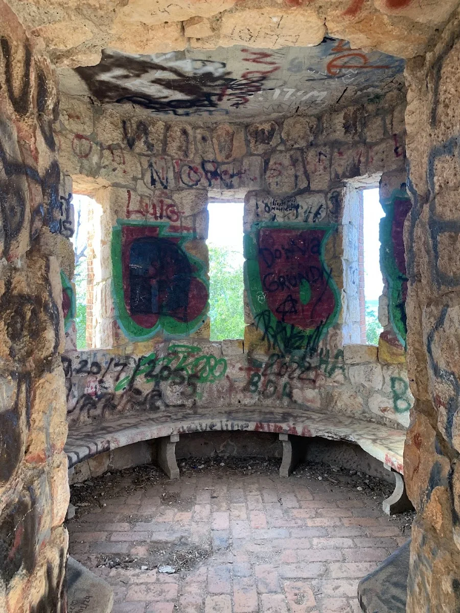
Fuerte Caprón sits on the south coast of Puerto Rico near Guánica municipality, a region shaped by trade winds and the Caribbean Sea. The 16th-century Spanish fort once guarded Guánica Bay during the colonial period, its strategic position reflecting Spain's control over Caribbean trade routes. The hilltop location provided defenders with commanding views of approaching vessels and coastal threats.
The crumbling fortress ruins that remain today blend seamlessly into Guánica's distinctive dry forest landscape, one of Puerto Rico's most arid ecosystems. The rocky shoreline below is remote and uncrowded, attracting visitors who seek solitude and raw coastal character rather than developed beach amenities. This stretch of coast carries the character of its surroundings—historical, rugged, and deeply connected to Puerto Rico's colonial past.
Nearby Attractions
Fuerte Caprón is situated in Guánica, a municipality with several attractions worth exploring beyond the beach itself. The Guánica town center features a central plaza with a church, local shops, and cafes—a good place to experience everyday Puerto Rican town life. Weekend markets and festivals throughout the year, particularly during patron saint celebrations (fiestas patronales), feature live music, food, and cultural performances.
- Nearby beaches – Gilligan's Island, Playa Ballena, and Playa La Jungla each offer different coastal character worth exploring if you have time for beach hopping
- Local restaurants and kiosks (chinchorros) – serving traditional Puerto Rican fare including fresh seafood, mofongo (mashed plantain with garlic), and tostones (fried plantain slices)
- Weekend food stalls – selling empanadillas, bacalaítos (codfish fritters), and piraguas (shaved ice with fruit syrup) at affordable prices
- Local recommendations – ask residents for their favorite dining spots; the best food is often at the least conspicuous establishments
Local Tips
- Watch your footing on fort ruins – The fortress is unprotected, with no guardrails, safety barriers, or maintained walkways. Crumbling walls and steep edges demand careful attention with every step.
- Pack all water and supplies – No food, water, or amenities exist at the beach or fort ruins. The nearest services are back in Guánica town, so bring everything you need.
- Pack light but pack wisely – The short but steep trail with loose gravel is challenging enough without excess weight. Bring only essentials, but ensure those essentials include plenty of water and sun protection.
- Beach access is a legal right – As with all Puerto Rico beaches, the beach zone up to the high-tide mark is public land by law, regardless of adjacent private property or signage suggesting otherwise.
- Leave no trace – Pack out all trash and leave the beach as you found it. Puerto Rico's coastal ecosystems are under pressure from development and climate change; responsible visitors make a real difference.
- Protect sea turtles – Between April and November, sea turtles may nest on sandy beaches. If you spot a nest or hatchlings, keep your distance and report it to the DRNA (Department of Natural Resources).
- Learn basic Spanish phrases – Spanish is the primary language in most areas outside San Juan's tourist zones. Phrases like '¿Dónde está la playa?' (Where is the beach?) and 'Gracias' (Thank you) go a long way with locals. Puerto Ricans are generally warm and helpful toward visitors who show respect for the culture and environment.
Frequently Asked Questions
Where is Fuerte Caprón located?
Is Fuerte Caprón good for swimming?
What facilities are available at Fuerte Caprón?
What activities can I do at Fuerte Caprón?
Is there parking at Fuerte Caprón?
What is the best time to visit Fuerte Caprón?
Practical Info
No lifeguards, facilities, or cell phone coverage exist at the beach or fort ruins above. The rocky shoreline requires careful footing with appropriate water shoes. The trail to the fort is short but steep with loose gravel and no handrails. The crumbling fort ruins have no guardrails, safety barriers, or maintained walkways, so watch every step near edges and walls. Bring all water and supplies as the nearest services are back in Guanica town.
Planning Your Visit
Similar Beaches


Nearby Beaches


Explore by Activity
Discover More on Puerto Rico Beach Finder
Explore 460+ beaches across the island with filters, maps, and detailed guides.
Explore All Beaches