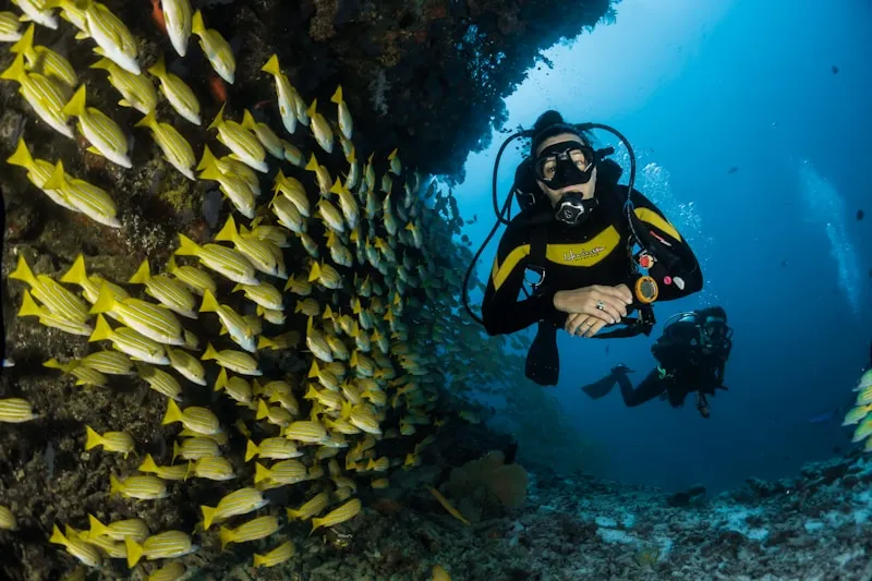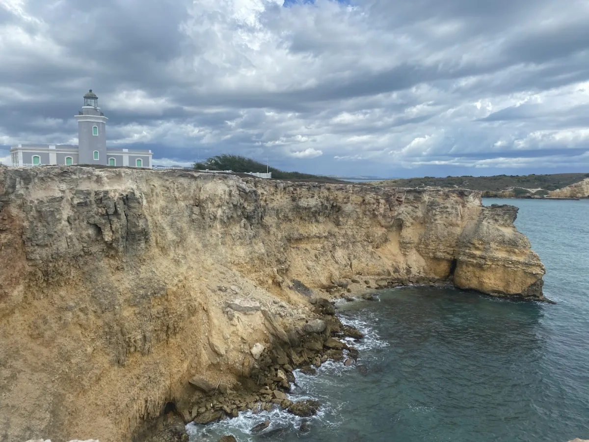
La Playuela (Playa Sucia) is a secluded beach in Cabo Rojo, Puerto Rico, known for scenic views and its secluded atmosphere. Facilities include parking.
Best for
- Scenic
- Secluded
Amenities
- ✓ Parking
Getting there
Road & short trail. Parking is limited but usually available due to the beach's remote location.
Best time
Best season: December through April offers the most pleasant weather with lower humidity. Morning visits (8am-11am) provide the best combination of good weather and manageable crowds.
Beach Score
rates for a day out
Conditions today
Live conditions unavailable right now.
Where it is
Ways to experience La Playuela (Playa Sucia)
Handpicked recommendations based on access, location and activities.
 Viator photoPopular Puerto Rico experienceAguadilla Tropical SnorkelingWe both love spending time in the ocean, that being surfing, bodysurfing, scubadiving, and swimming keeping safety our #1 priority, in order to have…◷ About 2 hoursFrom $98★ 5.0 (30)View on Viator ↗Rincón & west coast adventuresSurf lessons, Tres Palmas snorkeling, horseback rides and sunset sails.Browse tours ↗
We may earn a commission when you book through Viator links, at no extra cost to you.
About La Playuela (Playa Sucia)
La Playuela (Playa Sucia) is a stunning crescent beach in Cabo Rojo on Puerto Rico's southwestern tip, nestled below the iconic Los Morrillos Lighthouse. This secluded, exposed beach offers no services but rewards visitors with spectacular Caribbean vistas, dramatic coastal landscapes, and excellent sunset photography opportunities. The remote location and dry climate create a distinctive character perfect for those seeking solitude and natural beauty away from crowded tourist areas.
Local tips
Best Time to Visit+
Playuela Beach is best visited during the dry season from December through April, when the weather is clearest and Caribbean waters calmest. Summer months offer calm conditions ideal for swimming and snorkeling. Weekday mornings provide the best chance for solitude at this popular location; arrive early as crowds build by midday. Avoid holiday weekends when the access road becomes congested.
- December–April: Driest weather, calmest water, clearest skies for sunset views, and less crowding on weekdays
- May–November: Summer brings warmer water and calmer seas perfect for snorkeling, though afternoon thunderstorms are possible
- Early mornings on weekdays: Best time for solitude and photography with ideal light
- Late afternoon: Warm sunlight paints the cliffs beautifully, but expect the largest crowds of the day
What to Bring+
Sun and Water Protection:
- Reef-safe sunscreen (SPF 30 or higher)
- Hat or cap for sun protection
- Reusable water bottle (bring ample water as heat exposure is intense)
- Portable beach umbrella or pop-up shade tent (natural shade is limited)
For Snorkeling:
- Snorkel set (mask, snorkel, fins)
- Underwater camera (if available)
Food and Supplies:
- Food and snacks (no vendors on-site)
- Cooler with extra water and refreshments
- First aid kit
For Photography:
- Camera with extra battery
- Tripod for sunset shots
- Binoculars for coastal views
History & Background+
Playuela Beach is located in Cabo Rojo, the southwestern municipality of Puerto Rico famous for its salt flats, dramatic cliffs, and spectacular sunsets. Situated on the southwestern tip of the island, this area faces the Caribbean Sea with calm waters and a dry climate that creates a landscape distinct from the rest of Puerto Rico, where salt flats and scrubland meet the shore.
The beach itself is a remote cove within the Cabo Rojo National Wildlife Refuge, commonly called Playa Sucia. White sand, turquoise water, and dramatic limestone cliff walls define the landscape. The sheltered cove position and white sandy bottom create vivid turquoise water that contrasts sharply with the cliffs along the shore. A short trail from the beach leads to the historic Cabo Rojo Lighthouse perched on the cliffs above, offering sweeping coastal views in every direction.
Beaches like Playuela reflect the ongoing relationship between Cabo Rojo's coastal communities and the sea. Whether visited by local families on weekends or travelers discovering the area for the first time, this stretch of shoreline carries the character of its surroundings.
Nearby Attractions+
La Playuela (Playa Sucia) is situated in Cabo Rojo, which offers several attractions beyond the beach itself. The area is rich with natural and cultural destinations worth exploring during your visit.
- Los Morrillos Lighthouse: The iconic landmark directly above this beach, offering stunning views and historical significance. Well worth a visit if you have extra time.
- Cabo Rojo Salt Flats: Distinctive crystalline landscape famous for its visual appeal and cultural heritage tied to the salt-harvesting industry.
- Other Cabo Rojo beaches: Isla de Ratones (Cayo Ratones), Combate Playa Bohios (El Poblado Combate), and Pitahaya Cove each offer different character and experiences for beach hopping.
- Cabo Rojo town center: Features a central plaza with a church, local shops, and cafés where you can experience everyday Puerto Rican town life. Weekend markets and patron saint celebrations (fiestas patronales) occur throughout the year with live music, food, and cultural performances.
- Local dining: Roadside kiosks (chinchorros) and informal food stalls serving traditional Puerto Rican fare—fresh seafood, mofongo (mashed plantain with garlic), tostones (fried plantain slices), empanadillas, bacalaítos (codfish fritters), and piraguas (shaved ice with fruit syrup). Ask locals for their favorite spots; the best food is often at the least conspicuous establishments.
Local Tips+
- Photography: Shoot from the lighthouse cliffs for the iconic aerial-perspective view of the crescent beach
- Safety on cliffs: Do not climb the cliff faces; the limestone is soft and crumbles underfoot
- Beach access rights: The beach zone up to the high-tide mark is public land by law in Puerto Rico, regardless of any adjacent private property or signage suggesting otherwise
- Environmental responsibility: Pack out all trash and leave the beach as you found it. Puerto Rico's coastal ecosystems are under pressure, and responsible visitors make a real difference
- Sea turtle protection: Between April and November, sea turtles may nest on sandy beaches. If you spot a nest or hatchlings, keep your distance and report it to the DRNA (Department of Natural Resources)
- Coral protection: When snorkeling, avoid touching or standing on coral formations. They are fragile and legally protected. Maintain neutral buoyancy and keep your fins from scraping the bottom
- Language and cultural respect: Spanish is the primary language in most areas outside San Juan's tourist zones. Learning phrases like '¿Dónde está la playa?' (Where is the beach?) and 'Gracias' (Thank you) goes a long way. Puerto Ricans are generally warm and helpful toward visitors who show respect for the culture and environment
Getting there & safety
Access
Road & short trail. Parking is limited but usually available due to the beach's remote location.
Swim smart
No lifeguards are present. Swim at your own risk and never swim alone. Apply waterproof sunscreen regularly - the tropical sun is strong. Check weather conditions before visiting, especially during hurricane season (June-November).
Help the next person plan this beach
Add recent photos, leave a review, or report today's conditions.
Photos
Be the first to add a photo
Recent photos help others recognize the access point, water, and parking setup.
Community reviews
No Puerto Rico Beach Finder reviews yet
Share whether access was easy, how the water felt, and what the next person should know.
Planning your visit
Explore by activity
Nearby beaches
View location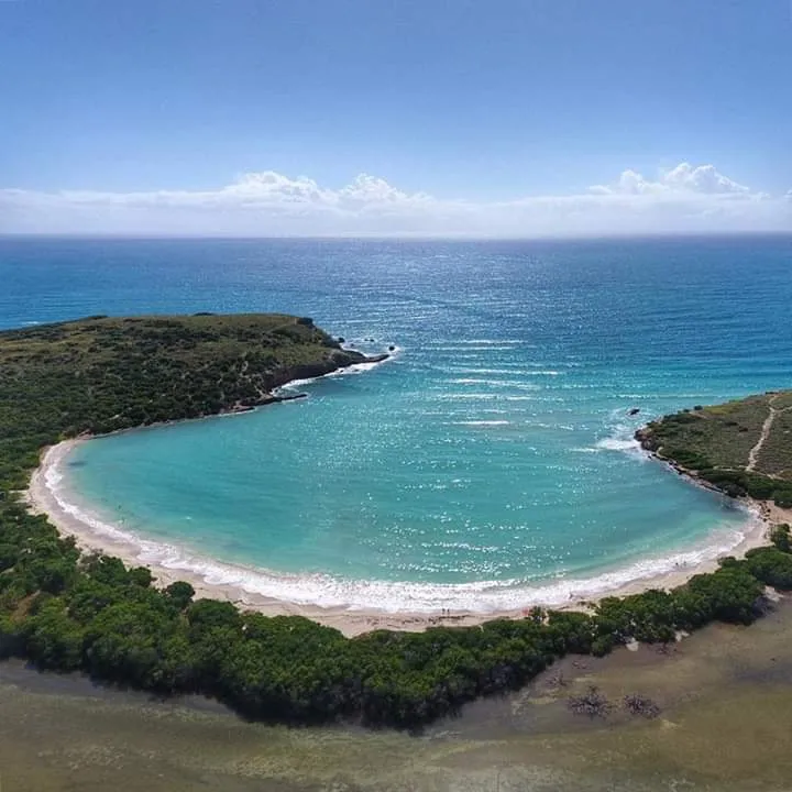


Similar beaches
Questions
Where is La Playuela (Playa Sucia) located?
La Playuela (Playa Sucia) is located in Cabo Rojo, Puerto Rico. The exact coordinates are 17.936031, -67.189038. You can use GPS navigation or follow signs to Cabo Rojo and look for beach access points.
Is La Playuela (Playa Sucia) good for swimming?
Yes, La Playuela (Playa Sucia) is a public beach open for swimming.
What facilities are available at La Playuela (Playa Sucia)?
La Playuela (Playa Sucia) offers the following facilities: Parking.
What activities can I do at La Playuela (Playa Sucia)?
Popular activities at La Playuela (Playa Sucia) include swimming, snorkeling. The beach is perfect for a day trip from Cabo Rojo.
Is there parking at La Playuela (Playa Sucia)?
Yes, La Playuela (Playa Sucia) has parking available.
What is the best time to visit La Playuela (Playa Sucia)?
The best time to visit La Playuela (Playa Sucia) is during Puerto Rico's dry season from December to April. For fewer crowds, visit on weekday mornings. Always check weather conditions before visiting.
Discover more beaches
Explore 400+ beaches across the island with filters, maps, and detailed guides.
Explore all beaches