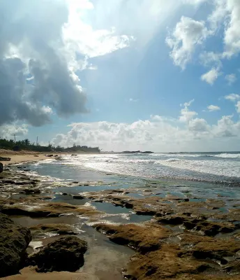
Playa Tamarindo (Guayanilla) is a beach in Guayanilla, Puerto Rico, known for scenic views. Playa Tamarindo in Guayanilla is a scenic open-coast beach on Puerto Rico's southern Caribbean shore, located west of Guayanilla Bay between Ponce and Yauco. Facilities include parking.
- Scenic
- ✓ Parking
Roadside access.
Best season: December through April offers the most pleasant weather with lower humidity.
Swim with a buddy and know your limits.
Bring water, shade, and food for the day.
Ways to experience Playa Tamarindo
Bookable tours and activities at and around this beach.
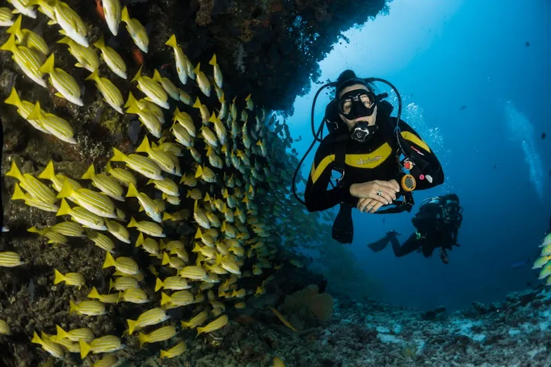
 Viator photoPopular Puerto Rico experienceTanama River Cave Tubingour tour is offered at the heart of a subtropical forest through private access and completely away from crowds. Following old trails left by our…◷ About 6 hours✓ Free cancellationFrom $110Check availability ↗Browse more tours on Viator ↗
We may earn a commission when you book through Viator links, at no extra cost to you.
About Playa Tamarindo
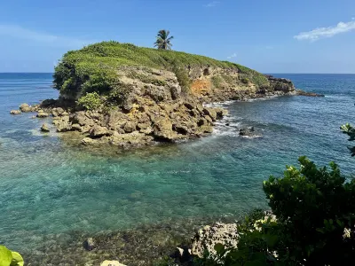
Playa Tamarindo in Guayanilla is a scenic open-coast beach on Puerto Rico's southern Caribbean shore, located west of Guayanilla Bay between Ponce and Yauco. This visually stunning strand features picturesque headlands and calm waters sheltered from Atlantic swells. With limited services and a rugged, natural character, it offers a quieter alternative to busier beaches, perfect for photography and experiencing the authentic southern coast landscape.
Local tips
What to Bring+
Photography & Viewing:
- Camera with extra batteries – Essential for capturing the scenic headlands and coastal views
- Tripod – Recommended for sunset photography and steady shots
- Binoculars – Useful for enjoying coastal vistas and wildlife observation
Sun & Weather Protection:
- Reef-safe sunscreen (SPF 30 or higher) – Apply regularly; tropical sun is intense between 10 AM and 2 PM
- Hat or cap – Essential for head and face protection
- Portable beach umbrella or pop-up shade tent – Highly recommended; natural shade is limited
- Lightweight, long-sleeved cover-up – Additional sun protection option
Hydration & Sustenance:
- Reusable water bottle – Staying hydrated in tropical heat is critical
- Cooler with meals, snacks, and extra water – No food vendors at or near this beach; bring your own provisions
Safety & General:
- Waterproof sunscreen – Essential for water activities; reapply frequently
- Check weather conditions – Especially during hurricane season (June–November) before visiting
- Never swim alone – No lifeguards present; swim at your own risk with a companion
History & Background+
Playa Tamarindo is located in Guayanilla, a municipality on Puerto Rico's southern Caribbean coast positioned between Ponce and Yauco. Situated on an open-coast strand west of Guayanilla Bay, this beach benefits from the calmer, warmer waters characteristic of the Caribbean side, sheltered from Atlantic swells by the island's central mountain range. The protected southern exposure provides better underwater visibility than many northern beaches.
This stretch of shoreline is renowned for its stunning coastal views and picturesque headlands, making it a visually striking destination for visitors and photographers. The municipality of Guayanilla has deep historical roots in Puerto Rico's heritage, and beaches like Playa Tamarindo reflect the enduring relationship between the local community and the sea. Whether visited by local families or travelers discovering the area for the first time, this beach carries the authentic character of Puerto Rico's southern coast.
Nearby Attractions+
Playa Tamarindo sits within the municipality of Guayanilla, which offers several attractions beyond the beach itself. The area is rich with both natural attractions and cultural experiences that complement a beach visit.
- Guayanilla Bay and offshore keys – Well worth exploring if you have extra time; scenic water-based attractions
- Playa De Guayanilla – Another beach in the Guayanilla area worth visiting for comparison
- Peñuelas neighborhood – Short drive away; worth exploring for local character and additional amenities
- Guayanilla town center – Features a central plaza with church, local shops, and cafes; excellent for experiencing everyday Puerto Rican town life
- Local restaurants and chinchorros (roadside kiosks) – Serve traditional Puerto Rican fare including fresh seafood, mofongo (mashed plantain with garlic), and tostones (fried plantain slices)
- Weekend food stalls – Sell empanadillas, bacalaítos (codfish fritters), and piraguas (shaved ice with fruit syrup) at affordable prices; ask locals for their favorite spots
- Weekend markets and fiestas patronales (patron saint celebrations) – Held throughout the year in nearby towns; feature live music, food, and cultural performances
Photos
Be the first to add a photo
Recent photos help others recognize the access point, water, and parking setup.
Reviews
No Puerto Rico Beach Finder reviews yet
Share whether access was easy, how the water felt, and what the next person should know.
Planning your visit
Explore by activity
Nearby beaches
Questions
Where is Playa Tamarindo (Guayanilla) located?
Playa Tamarindo (Guayanilla) is located in Guayanilla, Puerto Rico. The exact coordinates are 17.9749, -66.7815. You can use GPS navigation or follow signs to Guayanilla and look for beach access points.
Is Playa Tamarindo (Guayanilla) good for swimming?
Yes, Playa Tamarindo (Guayanilla) is a public beach open for swimming.
What facilities are available at Playa Tamarindo (Guayanilla)?
Playa Tamarindo (Guayanilla) offers the following facilities: Parking.
What activities can I do at Playa Tamarindo (Guayanilla)?
Popular activities at Playa Tamarindo (Guayanilla) include swimming, relaxing, sunbathing. The beach is perfect for a day trip from Guayanilla.
Is there parking at Playa Tamarindo (Guayanilla)?
Yes, Playa Tamarindo (Guayanilla) has parking available.
Similar beaches
Discover more beaches
Explore 400+ beaches across the island with filters, maps, and detailed guides.
Explore all beaches