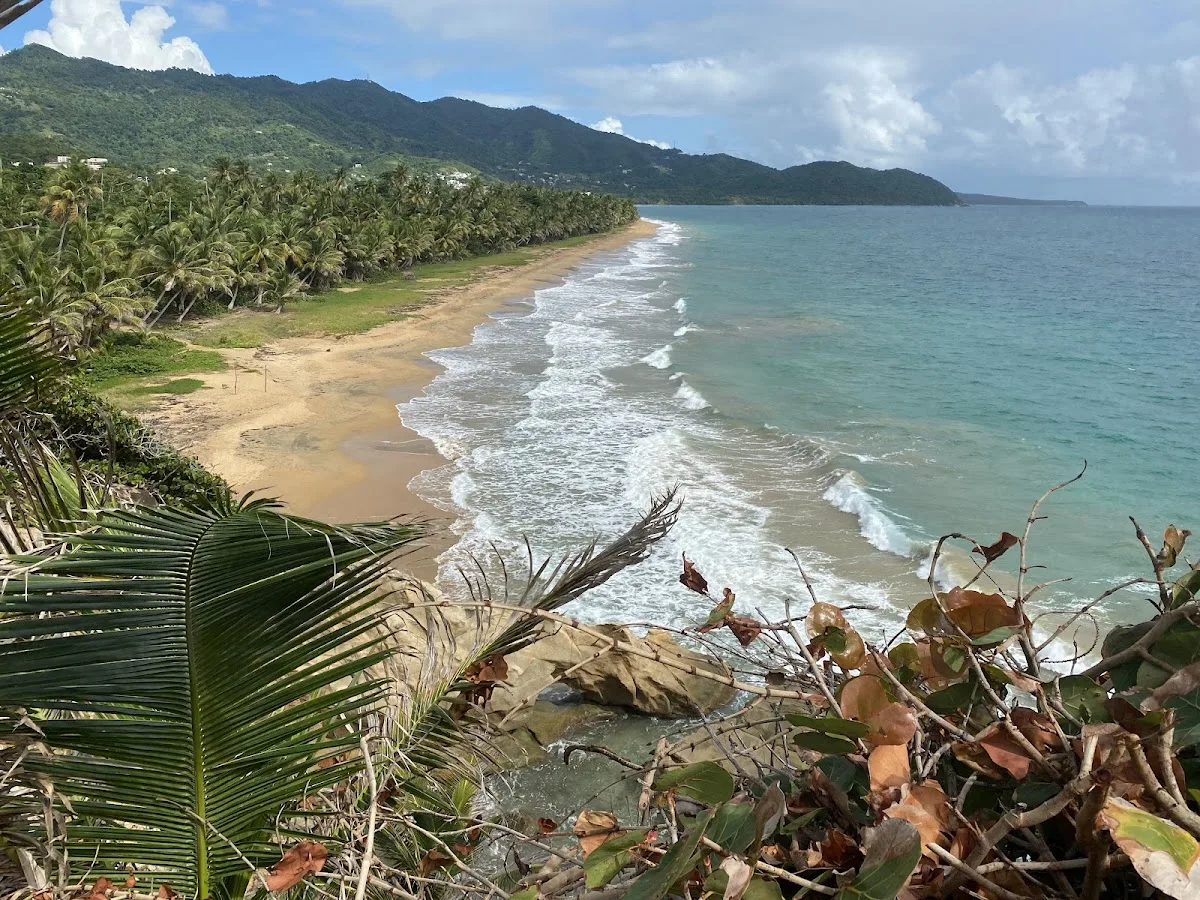
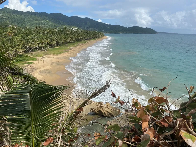
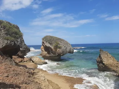
Punta Tuna Beach is a secluded beach in Maunabo, Puerto Rico, known for scenic views and its secluded atmosphere. Located at Puerto Rico's southeasternmost point, Punta Tuna Beach features the historic 1892 Spanish lighthouse overlooking dramatic volcanic rock formations and powerful Atlantic waves. Facilities include parking.
Best for
- Fishing
- Scenic
- Secluded
Amenities
- ✓ Parking
- ✓ Picnic Areas
Getting there
Short path. A small paved lot at the lighthouse park entrance provides space for about fifteen to twenty cars. Parking is free and the lot rarely fills except on holiday weekends. The access road off Route 760 is fully paved and easy to navigate with any vehicle type.
Best time
Morning visits are ideal when the lighthouse park gates are open and eastern light illuminates the rugged coast for photography. The area is enjoyable year-round, though winter months bring larger and more dramatic surf crashing against the rocks. Avoid major holidays when the small park can feel congested with families. Weekday mornings offer solitude and unobstructed views along the entire coastline from the lighthouse vantage point.
Beach Score
rates for a day out
Conditions today
Where it is
Ways to experience Punta Tuna Beach
Handpicked recommendations based on access, location and activities.
 Viator photoPopular Puerto Rico experienceRio Grande: Piñones Beach Buggy Adventure + El Yunque WaterfallsCelebrate unforgettable moments starting your day with an exciting Beach Buggy ride along the golden beaches and palm-lined trails of Piñones, Loíza…◷ About 6 hoursFrom $205★ 5.0 (53)View on Viator ↗Bio bay, Culebra & snorkeling tripsKayak the bioluminescent bay or sail to Culebra from Fajardo.Browse tours ↗
We may earn a commission when you book through Viator links, at no extra cost to you.
About Punta Tuna Beach
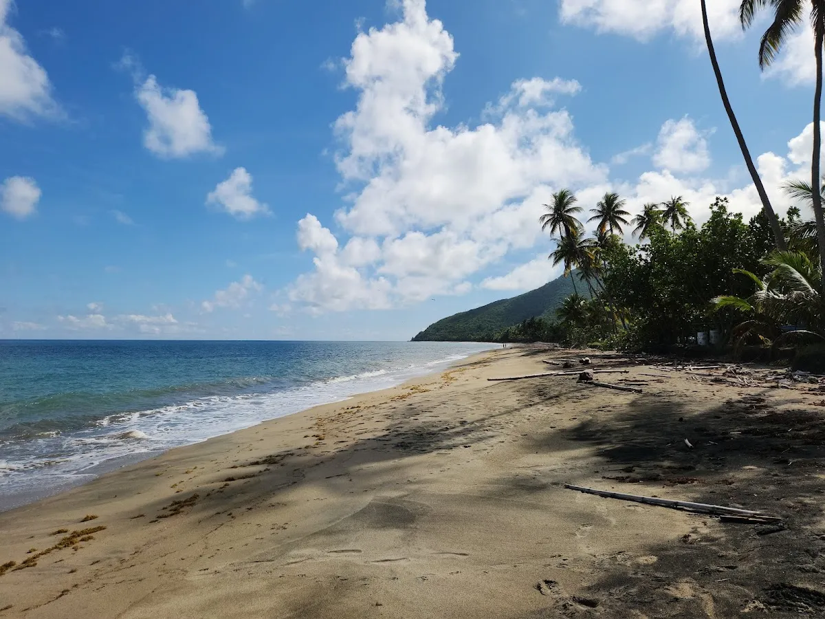
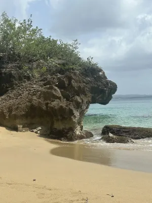
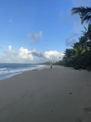
Located at Puerto Rico's southeasternmost point, Punta Tuna Beach features the historic 1892 Spanish lighthouse overlooking dramatic volcanic rock formations and powerful Atlantic waves. A palm-lined sandy strip curves along the scenic headland where Caribbean and Atlantic waters converge. Swimming is unsafe due to strong currents, but the free lighthouse park offers photography, exploration, and fishing from the rocks. An isolated, wild destination for visitors seeking history and dramatic coastal scenery.
Local tips
Best Time to Visit+
The dry season from December through April provides the most reliable weather for visiting Punta Tuna. Since swimming is not recommended, the primary activities are exploring the lighthouse park, walking the beach, and observing rock formations. Dry conditions and comfortable temperatures make these activities most enjoyable during winter and early spring months.
- Weekdays offer a quieter experience with the park often nearly empty
- Weekends bring modest crowds, primarily Puerto Rican families on day trips
- Holiday weekends and summer vacation see the highest visitation
- Summer months are hotter with frequent afternoon rain showers and increased hurricane season risks
- Early morning provides exceptional photography light, with the lighthouse catching sunrise rays and illuminating rock formations beautifully
What to Bring+
- Sturdy walking shoes are essential for the sandy beach, volcanic rock formations, and grassy lighthouse grounds. Flip-flops are inadequate for rocky areas with sharp edges and uneven footing
- Camera is arguably the most important item. The lighthouse, rock formations, palm-lined beach, and dramatic coastal setting offer exceptional photographic subjects. Bring a wide-angle lens and tripod if available for sunrise photography
- Sunscreen and hat protect against the tropical sun. There is some shade under palm trees, but the lighthouse grounds and rock formations are exposed
- Drinking water and snacks are essential, as there are no vendors at Punta Tuna. The nearest food options are in Maunabo's town center, about 10 minutes' drive
- Fishing gear if you plan to fish from the rocks, a popular local activity. Exercise extreme caution on wet volcanic rock near the waterline, as currents are powerful
- Binoculars help with birdwatching, as boobies, pelicans, and tropicbirds frequent the headland
History & Background+
Punta Tuna Beach stands at the southeasternmost tip of Puerto Rico, marked by the Faro de Punta Tuna, a lighthouse built by the Spanish colonial government in 1892. This was one of the last major Spanish infrastructure projects before the Spanish-American War of 1898 transferred control to the United States. Constructed from reinforced masonry in neo-classical style, the tower rises above the rocky headland and served as a critical navigational aid for vessels rounding the southeastern corner of the island.
Maunabo, founded in 1799, developed as an isolated, self-reliant community surrounded by mountains and the Caribbean Sea. The area depended heavily on fishing and agriculture, with sugar cane as the primary crop through the 19th and early 20th centuries. The Punta Tuna lighthouse was listed on the National Register of Historic Places in 1981. The beach itself retains a wild quality shaped by the powerful currents where Caribbean and Atlantic waters meet, creating complex patterns that make swimming dangerous but productive fishing grounds.
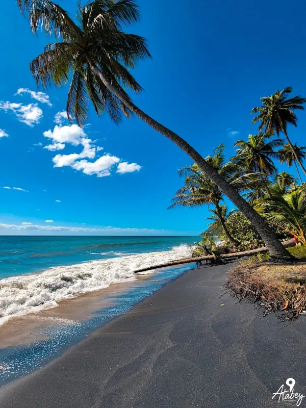
The dark, volcanic rock formations at Punta Tuna contrast with limestone karst found elsewhere on the island. Hurricane Maria in 2017 caused severe damage to the lighthouse and surrounding area, requiring restoration that strengthened community bonds and renewed attention to Maunabo's cultural and natural heritage.
Nearby Attractions+
The Faro de Punta Tuna is the primary attraction, featuring a small museum and interpretive displays about the lighthouse history and maritime navigation role. The tower may be open for climbing on certain days, offering views stretching from the Caribbean coast to mountain ridges.
- Maunabo town center is a quiet, traditional Puerto Rican small town with a plaza, church, and local restaurants serving comida criolla at local prices
- Playa Larga stretches north of the Punta Tuna headland and offers a longer, more accessible sandy shore popular with locals for walking and fishing
- Ruta Panorámica, Puerto Rico's mountain ridge road, is accessible via roads heading north from Maunabo into the highlands, passing through coffee country, tropical forest, and mountain communities
- Charco Azul natural pool in the Patillas area, about 30 minutes northwest, provides a freshwater swimming alternative
- Patillas, about 20 minutes west, is known as the Emerald of the South and offers access to Lake Patillas and surrounding mountain trails. The drive passes through sugarcane country with Caribbean views
Local Tips+
- Do not attempt to swim at Punta Tuna Beach. The currents at the southeastern tip of Puerto Rico are exceptionally strong, with the convergence of Caribbean and Atlantic waters creating unpredictable conditions. Even on calm days, subsurface currents can pull swimmers away from shore rapidly. This warning is not overstated; these waters have claimed lives
- The lighthouse grounds close at a posted time each day, typically late afternoon. Arrive with enough time to explore without rushing. You can still walk to the beach when the gate is closed, but the lighthouse park and facilities will be off-limits
- Allow extra time for the drive, especially if unfamiliar with the routes. The PR-15 mountain road between Cayey and Maunabo is beautiful but demanding, with narrow lanes, sharp curves, and occasional livestock. Do not drive this route at night unless necessary
- Bring everything you need, as Maunabo is a small town with limited commercial options. There is no major supermarket, only small colmados (neighborhood markets) with basic supplies. Stock up before leaving larger towns if you need specific items
- The picnic areas at the lighthouse park are the best spot for a packed lunch, with tables shaded by mature trees and ocean views. Arriving with a prepared meal turns a visit into a full half-day outing combining sightseeing, photography, and relaxation
Getting there & safety
Access
Short path. A small paved lot at the lighthouse park entrance provides space for about fifteen to twenty cars. Parking is free and the lot rarely fills except on holiday weekends. The access road off Route 760 is fully paved and easy to navigate with any vehicle type.
Swim smart
Swimming is extremely dangerous at this beach due to powerful converging currents, a rocky shoreline with no sandy entry point, and relentless pounding surf. This is strictly a sightseeing location where you observe the ocean from a safe distance on land. Stay on marked paths near the lighthouse and keep well back from wave-splashed rocks. Wet rocks are very slippery and rogue waves can surge further than expected.
Help the next person plan this beach
Add recent photos, leave a review, or report today's conditions.
Photos
Be the first to add a photo
Recent photos help others recognize the access point, water, and parking setup.
Community reviews
No Puerto Rico Beach Finder reviews yet
Share whether access was easy, how the water felt, and what the next person should know.
Planning your visit
Explore by activity
Nearby beaches
View location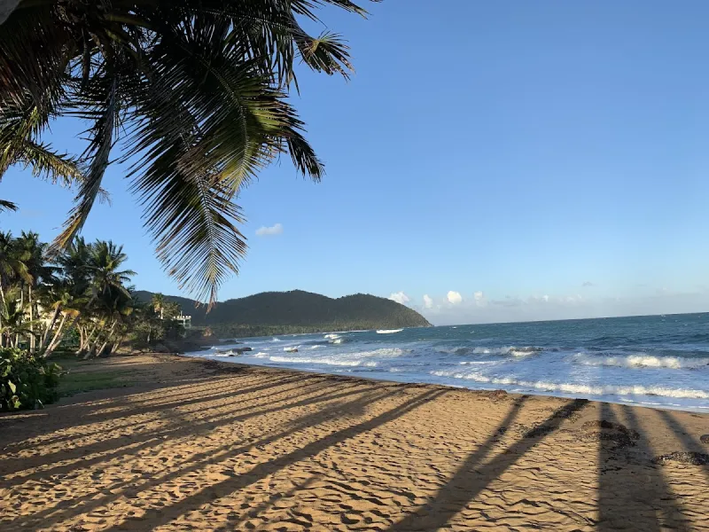
Similar beaches
Questions
Where is Punta Tuna Beach located?
Punta Tuna Beach is located in Maunabo, Puerto Rico. The exact coordinates are 17.990305, -65.88398. You can use GPS navigation or follow signs to Maunabo and look for beach access points.
Is Punta Tuna Beach good for swimming?
Yes, Punta Tuna Beach is a public beach open for swimming.
What facilities are available at Punta Tuna Beach?
Punta Tuna Beach offers the following facilities: Parking, Picnic Areas.
What activities can I do at Punta Tuna Beach?
Popular activities at Punta Tuna Beach include fishing. The beach is perfect for a day trip from Maunabo.
Is there parking at Punta Tuna Beach?
Yes, Punta Tuna Beach has parking available.
What is the best time to visit Punta Tuna Beach?
The best time to visit Punta Tuna Beach is during Puerto Rico's dry season from December to April. For fewer crowds, visit on weekday mornings. Always check weather conditions before visiting.
Discover more beaches
Explore 400+ beaches across the island with filters, maps, and detailed guides.
Explore all beaches